
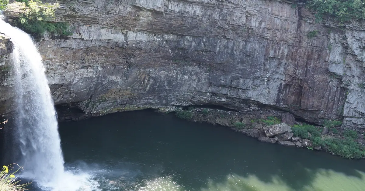

Alabama has 37 named waterfalls in the U.S. Geological Survey Geographic Names Information System, the features classified as Falls. That count ranks Alabama 20th among the 50 states. The figure comes from the GNIS domestic-names extract in this site, committed 2026-10-02, and this page was published 2026-11-19. The latest feature-edit date stored on these Falls records is December 30, 2020.
National rank and density
Divided by the state's land area of 50,651 square miles, from the U.S. Census Bureau 2024 Gazetteer (ALAND_SQMI, land only, inland water excluded), Alabama has 0.73 named falls per 1,000 square miles. That density ranks 25th of the 50 states. The national named total in this extract is 2,514 falls across the 50 states, so Alabama holds 1.5 percent of them.
Bordering states, with their named-falls counts: Florida (1, no separate count page); Georgia (28); Mississippi (4, no separate count page); Tennessee (81).
Where the named falls cluster
Alabama's named falls are filed under 18 county equivalents. The largest counts are DeKalb (6), Marshall (4), and Lawrence (3), 13 falls and 35.1 percent of the state total.
The Alabama waterfall map plots the same named falls. County names are the labels GNIS recorded. Connecticut's file uses planning regions, Alaska's uses boroughs and census areas, and Louisiana's uses parishes, so the column is not always a traditional county.
| County or equivalent | Named falls | Share | Examples |
|---|---|---|---|
| DeKalb | 6 | 16.2% | De Soto Falls, Griffin Falls, High Falls |
| Marshall | 4 | 10.8% | Piney Branch Falls, Ragsdale Falls, Short Creek Falls |
| Lawrence | 3 | 8.1% | Kinlock Falls, Parker Cascades, The Fall Off |
| Morgan | 3 | 8.1% | Ditto Falls, Seven Falls, Welcome Falls |
| Shelby | 3 | 8.1% | Davis Falls, Peavine Falls, Weaver Falls |
| Talladega | 3 | 8.1% | Great Falls, Rendalia Water Falls, Salt Creek Falls |
| Elmore | 2 | 5.4% | Tallapoosa Falls (historical), Wetumpka Falls |
| Jackson | 2 | 5.4% | High Falls, Little Falls |
| Winston | 2 | 5.4% | Parker Falls, Quarter Creek Falls |
| Colbert | 1 | 2.7% | Georgia Falls |
| Etowah | 1 | 2.7% | Noccalula Falls |
| Franklin | 1 | 2.7% | Butler Falls |
| Houston | 1 | 2.7% | Rock Falls |
| Jefferson | 1 | 2.7% | Village Falls |
| Lee | 1 | 2.7% | Great Falls |
| Mobile | 1 | 2.7% | Cedar Creek Falls |
| Randolph | 1 | 2.7% | High Shoals Falls |
| Tuscaloosa | 1 | 2.7% | University Falls (historical) |
Every named fall in the extract:
| Name | County or equivalent | On this site |
|---|---|---|
| Butler Falls | Franklin | Listed on the state guide |
| Cedar Creek Falls | Mobile | Listed on the state guide |
| Davis Falls | Shelby | Listed on the state guide |
| De Soto Falls | DeKalb | Published page |
| Ditto Falls | Morgan | Listed on the state guide |
| Georgia Falls | Colbert | Published page |
| Great Falls | Lee | Published page |
| Great Falls | Talladega | Listed on the state guide |
| Griffin Falls | DeKalb | Published page |
| High Falls | DeKalb | Published page |
| High Falls | Jackson | Listed on the state guide |
| High Shoals Falls | Randolph | Listed on the state guide |
| Kinlock Falls | Lawrence | Published page |
| Little Falls | DeKalb | Listed on the state guide |
| Little Falls | Jackson | Listed on the state guide |
| Little River Falls | DeKalb | Published page |
| Noccalula Falls | Etowah | Published page |
| Parker Cascades | Lawrence | Listed on the state guide |
| Parker Falls | Winston | Listed on the state guide |
| Peavine Falls | Shelby | Published page |
| Piney Branch Falls | Marshall | Listed on the state guide |
| Quarter Creek Falls | Winston | Listed on the state guide |
| Ragsdale Falls | Marshall | Listed on the state guide |
| Rendalia Water Falls | Talladega | Listed on the state guide |
| Rock Falls | Houston | Listed on the state guide |
| Salt Creek Falls | Talladega | Published page |
| Seven Falls | Morgan | Listed on the state guide |
| Short Creek Falls | Marshall | Published page |
| Swindell Falls | DeKalb | Listed on the state guide |
| Tallapoosa Falls (historical) | Elmore | Listed on the state guide |
| The Fall Off | Lawrence | Listed on the state guide |
| Thompson Falls | Marshall | Listed on the state guide |
| University Falls (historical) | Tuscaloosa | Listed on the state guide |
| Village Falls | Jefferson | Listed on the state guide |
| Weaver Falls | Shelby | Listed on the state guide |
| Welcome Falls | Morgan | Listed on the state guide |
| Wetumpka Falls | Elmore | Listed on the state guide |
Why Alabama's count looks like this
Alabama’s named falls are the last of the Appalachians. DeKalb County leads, on Lookout Mountain and Sand Mountain, where the Cumberland Plateau’s sandstone cap is still intact and creeks fall off the rim. Marshall, Jackson and the other northeast counties repeat that rim. South of the plateau the state is coastal plain. The Falls class almost disappears.
These are not tall western falls. They are caprock drops, often seasonal, in a humid climate that grows a lot of rhododendron and a lot of poison ivy on the same trail. The state’s rank is a northeast-corner rank. Birmingham and the Gulf coast are not part of the count in any meaningful way.
Named falls we publish
We publish a full page for 11 of the 37 named falls. A page exists when the fall has at least 25 Google reviews, a sourced trip guide, or at least 200 characters of USGS description or history. The other 26 stay on the state guide as names and coordinates. The Alabama state guide lists these same named falls.
- Noccalula Falls (Etowah · 1,271 Google reviews)
- De Soto Falls (DeKalb · 568 Google reviews)
- Kinlock Falls (Lawrence · 221 Google reviews)
- Little River Falls (DeKalb · 174 Google reviews)
- Great Falls (Lee · 82 Google reviews)
- Peavine Falls (Shelby · 57 Google reviews · Peavine Falls Trail)
- High Falls (DeKalb · 47 Google reviews)
- Griffin Falls (DeKalb · 40 Google reviews)
- Salt Creek Falls (Talladega · 40 Google reviews)
- Short Creek Falls (Marshall · 28 Google reviews)
- Georgia Falls (Colbert)
Tallest falls on the record
The national roundup, the largest waterfalls in the U.S. by state, does not name a single well-documented tallest waterfall for Alabama. Separately, the tallest height written into the USGS gazetteer text in our file is De Soto Falls at 104 feet, Noccalula Falls at 90 feet, and Georgia Falls at 70 feet. Most Falls records state no height, so this is not a ranking of the tallest waterfall in the state.
National parks
None of the national park guides on this site currently include a published waterfall inside Alabama. Named falls here are on other public or private land. The state guide is the place to check access. We do not assign falls to a national forest unless a park boundary in our file contains them.
Trails we can measure
These distances come from the trail notes already attached to the published pages, either a sourced trip guide or an OpenStreetMap path. A blank distance means the map did not give one we were willing to print.
- Peavine Falls: Peavine Falls Trail
When to go in Alabama
December through April is the dependable stretch, when frontal storms keep the plateau creeks up. A dry May can already shrink the smaller DeKalb County drops. Summer thunderstorms refill them briefly and make the rock slick. Winter is mild enough to hike and wet enough to be worth it, which is the opposite of the northern states on this list.
How this number was counted
Named falls are records with feature class Falls in the USGS National Map GNIS domestic names, filtered to this state in data/gnis-waterfalls.json. The download script is scripts/prepare-gnis.mjs, pointed at the USGS domestic-names file. Land area is ALAND_SQMI in the Census Bureau 2024 Gazetteer national state file, written by scripts/prepare-state-areas.mjs. Density is named falls divided by land area, times 1,000. The full 50-state ranking, including states with too few named falls for their own page, is Which state has the most waterfalls?.
Frequently asked questions
How many waterfalls are in Alabama?
Alabama has 37 named waterfalls in the USGS GNIS Falls class, ranking 20th of the 50 states. The extract used here was committed 2026-10-02, and this page was published 2026-11-19.
Which county in Alabama has the most named waterfalls?
DeKalb has the most, with 6 named falls. Marshall is next with 4.
How many Alabama waterfalls have a page on this site?
11 of the 37 named falls have a published page. A page requires 25 or more Google reviews, a sourced trip guide, or at least 200 characters of USGS description or history.
When is the best time to see waterfalls in Alabama?
December through April is the dependable stretch, when frontal storms keep the plateau creeks up. A dry May can already shrink the smaller DeKalb County drops. Summer thunderstorms refill them briefly and make the rock slick. Winter is mild enough to hike and wet enough to be worth it, which is the opposite of the northern states on this list.
Where in Alabama are the named waterfalls?
In the northeast, on the tail of the Cumberland Plateau. DeKalb County has the most. South Alabama’s coastal plain has essentially none in this extract.