
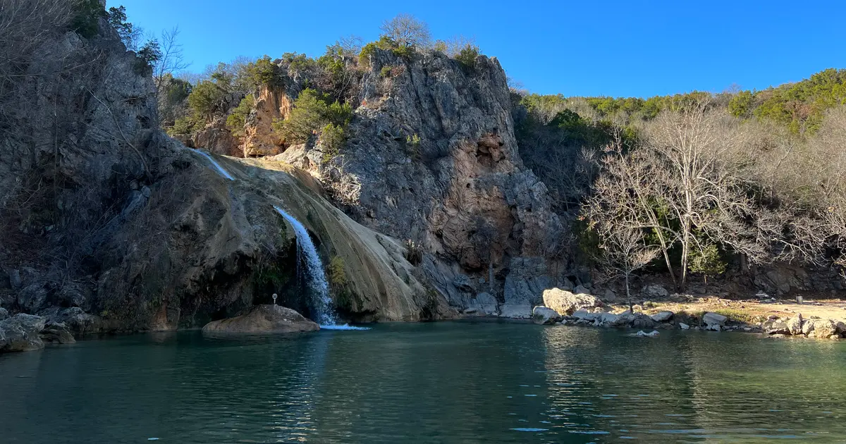

Oklahoma has 26 named waterfalls in the U.S. Geological Survey Geographic Names Information System, the features classified as Falls. That count ranks Oklahoma tied for 24th with Arizona and Massachusetts among the 50 states. The figure comes from the GNIS domestic-names extract in this site, committed 2026-10-02, and this page was published 2026-11-19. The latest feature-edit date stored on these Falls records is December 30, 2020.
National rank and density
Divided by the state's land area of 68,597 square miles, from the U.S. Census Bureau 2024 Gazetteer (ALAND_SQMI, land only, inland water excluded), Oklahoma has 0.38 named falls per 1,000 square miles. That density ranks 32nd of the 50 states. The national named total in this extract is 2,514 falls across the 50 states, so Oklahoma holds 1 percent of them.
Bordering states, with their named-falls counts: Arkansas (12); Colorado (80); Kansas (3, no separate count page); Missouri (6, no separate count page); New Mexico (14); Texas (30).
Where the named falls cluster
Oklahoma's named falls are filed under 9 county equivalents. The largest counts are Murray (14), Carter (3), and Johnston (3), 20 falls and 76.9 percent of the state total.
The Oklahoma waterfall map plots the same named falls. County names are the labels GNIS recorded. Connecticut's file uses planning regions, Alaska's uses boroughs and census areas, and Louisiana's uses parishes, so the column is not always a traditional county.
| County or equivalent | Named falls | Share | Examples |
|---|---|---|---|
| Murray | 14 | 53.8% | Bear Falls, Bridal Veil Falls, Cave Island Falls |
| Carter | 3 | 11.5% | Cedar Falls, Henry House Falls, Hickory Falls |
| Johnston | 3 | 11.5% | Big Falls, Cheadle Falls, Slippery Falls |
| Atoka | 1 | 3.8% | Rock Creek Falls |
| Cherokee | 1 | 3.8% | McSpadden Falls |
| Le Flore | 1 | 3.8% | Hontubby Falls |
| McCurtain | 1 | 3.8% | Presbyterian Falls |
| Sequoyah | 1 | 3.8% | Webbers Falls (historical) |
| Wagoner | 1 | 3.8% | Lower Verdigris Falls (historical) |
Every named fall in the extract:
| Name | County or equivalent | On this site |
|---|---|---|
| Bear Falls | Murray | Listed on the state guide |
| Big Falls | Johnston | Listed on the state guide |
| Bridal Veil Falls | Murray | Listed on the state guide |
| Cave Island Falls | Murray | Listed on the state guide |
| Cedar Falls | Carter | Listed on the state guide |
| Cheadle Falls | Johnston | Listed on the state guide |
| Classen Falls | Murray | Listed on the state guide |
| Garfield Falls | Murray | Listed on the state guide |
| Henry House Falls | Carter | Listed on the state guide |
| Hickory Falls | Carter | Listed on the state guide |
| Hontubby Falls | Le Flore | Listed on the state guide |
| Lick Creek Falls | Murray | Listed on the state guide |
| Little Niagara Falls | Murray | Published page |
| Lost Falls | Murray | Listed on the state guide |
| Lower Verdigris Falls (historical) | Wagoner | Listed on the state guide |
| McSpadden Falls | Cherokee | Listed on the state guide |
| Panther Falls | Murray | Listed on the state guide |
| Pebble Falls | Murray | Listed on the state guide |
| Presbyterian Falls | McCurtain | Listed on the state guide |
| Price Falls | Murray | Listed on the state guide |
| Rock Creek Falls | Atoka | Listed on the state guide |
| Slippery Falls | Johnston | Listed on the state guide |
| Sycamore Falls | Murray | Listed on the state guide |
| Travertine Falls | Murray | Listed on the state guide |
| Turner Falls | Murray | Published page |
| Webbers Falls (historical) | Sequoyah | Listed on the state guide |
Why Oklahoma's count looks like this
Oklahoma’s plains are not the waterfall map. The named falls sit in the old, worn hills that break the prairie, and one of those hills dominates the file. Murray County, in the Arbuckle Mountains, holds about half the state’s names by itself. The Arbuckles are a small, intensely folded range of limestone and granite. Turner Falls is the visited piece of a county that the gazetteer treats as a cluster.
The Ouachitas and the Ozark edge in the east add a thinner share, rain-fed sandstone creeks rather than the Arbuckle limestone. Western Oklahoma does not appear. The state’s rank is an Arbuckle rank with a small Ouachita footnote.
Named falls we publish
We publish a full page for 2 of the 26 named falls. A page exists when the fall has at least 25 Google reviews, a sourced trip guide, or at least 200 characters of USGS description or history. The other 24 stay on the state guide as names and coordinates. The Oklahoma state guide lists these same named falls.
- Turner Falls (Murray · 2,526 Google reviews)
- Little Niagara Falls (Murray · 475 Google reviews · 0.4 miles one way)
Tallest falls on the record
The national roundup, the largest waterfalls in the U.S. by state, does not name a single well-documented tallest waterfall for Oklahoma. None of the USGS descriptions in our file state a height in feet for a named fall here. We do not estimate one.
National parks
None of the national park guides on this site currently include a published waterfall inside Oklahoma. Named falls here are on other public or private land. The state guide is the place to check access. We do not assign falls to a national forest unless a park boundary in our file contains them.
Trails we can measure
These distances come from the trail notes already attached to the published pages, either a sourced trip guide or an OpenStreetMap path. A blank distance means the map did not give one we were willing to print.
- Little Niagara Falls: Antelope Springs Trail, 0.4 miles one way
When to go in Oklahoma
Rain peaks in late spring, so March through early June is when both the Arbuckle and the eastern hills are most likely to be running. A hot, dry July can reduce the smaller creeks to a seep even when Turner Falls, on a larger spring-fed system, still has a flow. Fall storms are a second, less reliable window. Winter is generally too dry to be the reason to go.
How this number was counted
Named falls are records with feature class Falls in the USGS National Map GNIS domestic names, filtered to this state in data/gnis-waterfalls.json. The download script is scripts/prepare-gnis.mjs, pointed at the USGS domestic-names file. Land area is ALAND_SQMI in the Census Bureau 2024 Gazetteer national state file, written by scripts/prepare-state-areas.mjs. Density is named falls divided by land area, times 1,000. The full 50-state ranking, including states with too few named falls for their own page, is Which state has the most waterfalls?.
Frequently asked questions
How many waterfalls are in Oklahoma?
Oklahoma has 26 named waterfalls in the USGS GNIS Falls class, ranking tied for 24th with Arizona and Massachusetts of the 50 states. The extract used here was committed 2026-10-02, and this page was published 2026-11-19.
Which county in Oklahoma has the most named waterfalls?
Murray has the most, with 14 named falls. Carter is next with 3.
How many Oklahoma waterfalls have a page on this site?
2 of the 26 named falls have a published page. A page requires 25 or more Google reviews, a sourced trip guide, or at least 200 characters of USGS description or history.
When is the best time to see waterfalls in Oklahoma?
Rain peaks in late spring, so March through early June is when both the Arbuckle and the eastern hills are most likely to be running. A hot, dry July can reduce the smaller creeks to a seep even when Turner Falls, on a larger spring-fed system, still has a flow. Fall storms are a second, less reliable window. Winter is generally too dry to be the reason to go.
Why does Murray County have so many of Oklahoma’s named waterfalls?
Because the Arbuckle Mountains are there. Murray County holds about half the state’s Falls-class records, in a small range of limestone and granite surrounded by plains that do not produce named falls.