
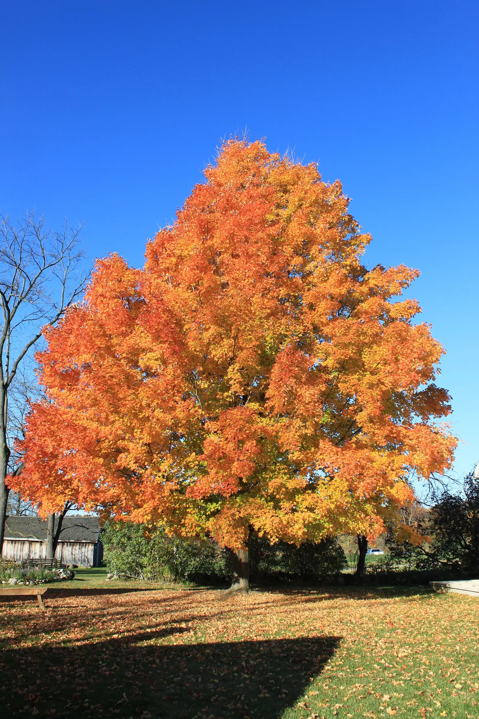
Pure Michigan’s fall color map says peak colors move through the state with the season, beginning in the northern Upper Peninsula and unfolding into the Lower Peninsula. The articles under that program are more specific than the map’s one sentence, and they do not all use the same kind of date. Some say “typically.” Some say “should be.” This page keeps that distinction.
The western Upper Peninsula is the early drive. An Ironwood–Silver City–Wakefield road-trip article says those roads tint the countryside from mid-September to early October. A separate Upper Peninsula county-road page says peak for the Upper Peninsula should be early October. Northern Lower Michigan is late September to early October in the Traverse City article, and one county-road page says northern Michigan peak should be October 7–14. Kalamazoo and Ann Arbor are the late end: late October and early November.
Peak timing varies from year to year. A warm fall, an early frost, or a windstorm can move or mute the color, which is why the live report matters more than any calendar.
When color usually arrives
Western Upper Peninsula
The Ironwood to Wakefield drive is dated mid-September to early October. Bond Falls, in Ontonagon County, sits in that western U.P. country. The broader U.P. line, “should be early October,” is a different sentence and is not a 10-year average.
Pure Michigan road-trip window, plus the U.P. “should be” line. Source: Pure Michigan, Ironwood–Silver City–Wakefield.
Central and eastern Upper Peninsula
Marquette’s leaf-peeping article says trees start to turn in mid-to-late September. Munising is the Pictured Rocks side of that central U.P. The Huron-Manistee National Forest, which is northern Lower Peninsula rather than the U.P., said on October 8, 2026 that peak was rapidly approaching and was expected to continue about two weeks.
Pure Michigan place articles; Huron-Manistee note is 2026. Source: Pure Michigan, leaf-peeping in Marquette.
Northern Lower Peninsula, then the south
Traverse City: northern Michigan turns from late September to early October. The northern Lower Peninsula county-road page says peak should be October 7–14. Kalamazoo: maples and beeches in late October and early November. Ann Arbor: late October and early November.
Pure Michigan city guides. Source: Pure Michigan, leaf-peeping in Ann Arbor.
Fall foliage map
Esri publishes a public ArcGIS experience called Fall Foliage Viewing. It is embedded here as a map you can pan. It is not the source of the dates on this site. If the embed is blocked or slow, the state reports linked above and below still stand on their own. For Michigan, it opens centered on the state. The center is the middle of the state's bounding box in the U.S. Census Bureau cartographic boundary, 2017 edition. The colored prediction layer in the experience is the Massachusetts Department of Conservation and Recreation forecast published in that app. It is not a forecast for any other state.
Map of waterfalls in Michigan
Larger gold markers are the waterfalls on this page's itinerary. Smaller markers are the other published waterfall pages in Michigan. The outline is the U.S. Census Bureau cartographic boundary for the state (2017, public domain). A marker is the mapped position of the falls, not a trailhead.
Published waterfall page On this foliage trip
On this trip
- Bond Falls, Ontonagon County
- Miners Falls, Alger County
- Munising Falls, Alger County
- Ocqueoc Falls, Presque Isle County
- Upper Falls, Luce County
Other published waterfall pages in Michigan
- Agate Falls, Ontonagon County
- Alder Falls, Marquette County
- Au Train Falls, Alger County
- Black River Falls, Marquette County
- Bonanza Falls, Ontonagon County
- Canyon Falls, Baraga County
- Chapel Falls, Alger County
- Chicagon Falls, Iron County
- Dead River Falls, Marquette County
- Eagle River Falls, Keweenaw County
- Fumee Falls, Dickinson County
- Gabbro Falls, Gogebic County
- Gorge Falls, Gogebic County
- Great Conglomerate Falls, Gogebic County
- Horseshoe Falls, Alger County
- Houghton Falls, Houghton County
- Hungarian Falls, Houghton County
- Interstate Falls, Gogebic County
- Jacobs Falls, Keweenaw County
- Kakabika Falls, Gogebic County
- Laughing Whitefish Falls, Alger County
- Manabezho Falls, Gogebic County
- Manido Falls, Gogebic County
- Memorial Falls, Alger County
- Morgan Falls, Marquette County
- Mosquito Falls, Alger County
- Nonesuch Falls, Ontonagon County
- O Kun de Kun Falls, Ontonagon County
- Pemene Falls, Menominee County
- Potawatomi Falls, Gogebic County
- Powder Horn Falls, Gogebic County
- Power House Falls, Baraga County
- Rainbow Falls, Gogebic County
- Rapid River Falls, Delta County
- Reany Falls, Marquette County
- Rock River Falls, Alger County
- Root Beer Falls, Gogebic County
- Sable Falls, Alger County
- Sandstone Falls, Gogebic County
- Saxon Falls, Gogebic County
- Scott Falls, Alger County
- Silver Falls, Baraga County
- Silver River Falls, Keweenaw County
- Spray Falls, Alger County
- Tannery Falls, Alger County
- Wagner Falls, Alger County
- Warner Falls, Marquette County
- Whitefish Falls, Alger County
- Wyandotte Falls, Houghton County
- Yellow Dog River Falls, Marquette County
Open the interactive Michigan waterfall map. That map also includes named falls that do not have their own page.
The live report
The map is the live view. The Forest Service also posted a 2026 story map for the Huron-Manistee, described as active until November 20, 2026. Pure Michigan fall color map.
Waterfalls to see with the color
Bond Falls is Ontonagon County. The USGS text calls it 50 feet. It is the western U.P. page, on the mid-September to early October drive. Munising Falls and Miners Falls are Alger County. The trail file gives Munising Falls 800 feet one way and Miners Falls 0.6 miles one way. Upper Falls near Newberry is Luce County, farther east. Ocqueoc Falls is Presque Isle County, in the northern Lower Peninsula, which is the late-September to mid-October band rather than the Ann Arbor band. The big southern cities do not have a published waterfall page in this set.
Bond Falls
Ontonagon County · nearest listed town Iron River
- Drop
- 50 ft in the USGS gazetteer text
- Reviews
- 685 · 4.9 stars
Munising Falls
Alger County · nearest listed town Munising
- Trail
- Munising Falls Trail
- Distance
- 800 feet one way
- Difficulty
- Easy, slightly uphill
- Reviews
- 525 · 4.6 stars
Miners Falls
Alger County · nearest listed town Munising
- Trail
- Miners Falls Trail
- Distance
- 0.6 mile one way
- Difficulty
- Easy to moderate
- Reviews
- 419 · 4.9 stars
Upper Falls
Luce County · nearest listed town Newberry
- Reviews
- 1,223 · 4.9 stars
Ocqueoc Falls
Presque Isle County · nearest listed town Rogers City
- Reviews
- 718 · 4.8 stars
Trail name, distance, elevation, and difficulty come from data/trails.json or a hand-checked trip note when one exists. A missing row means that field was not in those files. Drop is shown only when the USGS gazetteer text states a height.
West to east across the Upper Peninsula
Iron River and Ontonagon are the early stop. Alger County is the next. Luce County is farther east. Ocqueoc is across the bridge, and the Traverse City article’s late-September to early-October line is the Lower Peninsula timing to compare with it, not the Kalamazoo line. The straight-line miles will show this is a peninsula, not a park loop.
The Forest Service Eastern Region names M-22 and the Huron-Manistee for maple, oak, and poplar near Lake Michigan. That is a Lower Peninsula drive. It is not the road to Bond Falls.
| From | To | Straight-line miles |
|---|---|---|
| Bond Falls | Munising Falls | 119.6 |
| Munising Falls | Miners Falls | 5.6 |
| Miners Falls | Upper Falls | 61.0 |
| Upper Falls | Ocqueoc Falls | 99.7 |
Trees and the colors they are credited with
- Maple, oak, aspen, poplar, dogwood, beech. The Huron-Manistee 2026 release says maples give scarlet, orange-red, and yellow; oaks go red, brown, or russet; aspens and yellow-poplars go golden; dogwoods go purplish red; beech goes tan. That is the northern Lower Peninsula forest, not the Keweenaw. (Huron-Manistee National Forest, October 8, 2026)
Frequently Asked Questions
Where does Michigan color start?
Pure Michigan says the northern Upper Peninsula, unfolding into the Lower Peninsula. The western U.P. drive article says mid-September to early October from Ironwood toward the Porcupine Mountains.
When are Ann Arbor and Kalamazoo?
Late October and early November in the Pure Michigan city guides. That is weeks after the western U.P. window.
Which falls are in the western U.P.?
Bond Falls in Ontonagon County. Munising and Miners are Alger County. Upper Falls near Newberry is Luce County. Ocqueoc is Presque Isle County in the northern Lower Peninsula.
Photographs
Sources
- Pure Michigan, Ironwood–Silver City–Wakefield
- Pure Michigan, leaf-peeping in Marquette
- Pure Michigan, leaf-peeping in Ann Arbor
- Pure Michigan fall color map
- Huron-Manistee National Forest, October 8, 2026
- File:Bright Orange Fall Foliage, Waterloo Farm Museum, 9998 Waterloo Munith Rd, Waterloo Township, Michigan - panoramio.jpg
- File:Fall Foliage Vista, Oak Road, Augusta Township, Michigan - panoramio.jpg
- File:Copper Country Trail - Fall Foliage - NARA - 7717796.jpg