
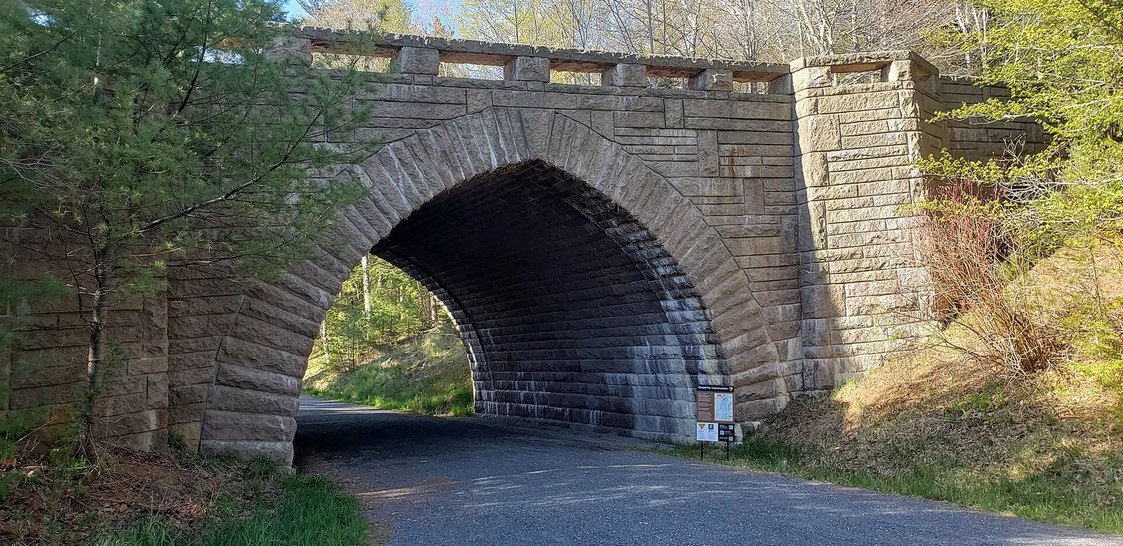
Acadia protects the highest rocky headlands on the Atlantic coast of the United States, with 27 miles of historic motor roads, 158 miles of hiking trails, and 45 miles of carriage roads. Hadlock Falls is the published fall tied to the park. USGS says "Located in Acadia NP." The mapped coordinate sits just outside the digitized boundary, within two kilometers, which is why the match is the gazetteer plus the NPS description rather than the polygon alone.
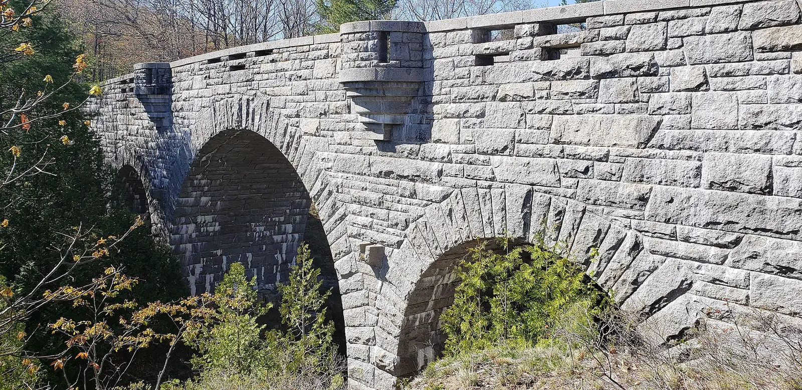
NPS says Waterfall Bridge, built in 1925, carries a carriage road over Upper Hadlock Brook at a 40-foot waterfall. The fall is not always there. The fast-facts article says it usually appears in spring and autumn, sometimes in early summer after enough rain, and that it is absent when the brook is low. The trail file gives 1.2 miles one way on Hadlock Ponds Trail. That distance is one way.
The falls on our maps
This is a carriage-road view of a brook that turns on and off, not a plunge you can count on in August. The article is the source for that, not a guess from the latitude.
Hadlock Falls
Hancock County, Maine · nearest listed town Bar Harbor (5.4 miles in a straight line)
- Trail
- Hadlock Ponds Trail
- Distance
- 1.2 miles one way (one way)
- Reviews
- 33 · 4.5 stars
Side by side
Distance is one way. Height is not filled from the "40-foot" bridge sentence unless you read the place page yourself. The place page says the bridge is 31 feet at its highest point and that the arch crosses a 40-foot waterfall. The table leaves the drop blank because our USGS text for the fall does not state a height, and the 40-foot figure is the bridge article's description of the scene.
| Waterfall | Distance | Elevation | Difficulty | USGS drop | Reviews | Flow note |
|---|---|---|---|---|---|---|
| Hadlock Falls | 1.2 miles one way | — | — | — | 33 | — |
A dash means that field is not in the USGS gazetteer text, the trail file, or the hand-checked trip notes for that fall. It is not a claim that the number is zero.
Effort against attention
One fall, 1.2 miles one way, 33 reviews. Reviews per mile is a single number and not a ranking. The walk is as long as the trail file says and no easier or harder word is stored, so no difficulty is displayed. The crowd signal is the small review count next to a famous park: Hadlock is not the place the review data says everyone writes about.
Seeing more than one
The sourced outing is the carriage-road approach in the trail file, 1.2 miles one way, timed for spring, autumn, or a rainy early summer if you want water in the brook. A second day of waterfall hiking is not in this dataset. Cadillac Summit Road, which needs its own vehicle reservation from mid-May into October, is a different destination. The fee page says that reservation is sold only online.
When the nearest gauge runs high
Otter Creek near Bar Harbor, Maine (USGS 01022840) sits 3.6 miles from Hadlock Falls. Across 2019–2024 the mean daily flow was highest in March (8 cfs) and lowest in July (2 cfs). Hadlock Brook is a small carriage-road stream. A gauge on a larger Mount Desert stream is a rainfall cousin, not a measurement of this brook. The NPS sentence about spring and autumn is the timing line to trust for the fall itself.
| Jan | Feb | Mar | Apr | May | Jun | Jul | Aug | Sep | Oct | Nov | Dec |
|---|---|---|---|---|---|---|---|---|---|---|---|
| 5 | 4 | 8 | 8 | 3 | 4 | 2 | 2 | 4 | 4 | 4 | 8 |
Fees, passes, and entry rules
A $35 vehicle pass, a printed dashboard pass, and a separate summit-road reservation that this hike does not use.
- Private vehicle
- $35 for seven days, including rental cars and RVs under 16 passenger seats.
- On foot or bicycle
- $20 for seven days. Youth 15 and under are free on this rate.
- Motorcycle
- $30 for seven days.
- Non-US residents
- $100 per person age 16 and older, added to the entrance fee, unless admitted with an annual or America the Beautiful pass.
- Cadillac Summit Road
- A separate vehicle reservation is required to drive Cadillac Summit Road from mid-May into October. It is sold only online, not at the park. That reservation is for the summit road, not for every carriage-road walk.
- Pass display
- Entrance passes have to be printed and left on the dashboard. Cell service in the park is described as extremely limited.
Getting there
Entrance passes must be printed and displayed. The fee page says cell service is extremely limited, so an unprinted QR code is a bad plan. Non-US residents pay an additional $100 per person unless they hold an annual or America the Beautiful pass. The summit reservation is extra and is not sold at the park.
What this park warns about
The sourced risk is showing up when the brook is dry and calling it closed. The article says there is a waterfall when there is enough water, typically spring and autumn. No cliff or tide warning is attached to this fall in the sources, so none is added. The carriage roads are closed to cars. That is the design of the road system in the bridge article, not a trail closure.
Small things the official pages mention
- The fall under Waterfall Bridge is typically seen in spring and autumn, and sometimes in early summer after rain. (NPS Waterfall Bridge)
- Cadillac Summit Road reservations are separate, online only, mid-May into October. (NPS fees)
- Print the entrance pass. Cell service is described as extremely limited. (NPS fees)
Towns our directory files these falls under
Bar Harbor is the nearest city in our index, about 5 straight-line miles from the coordinate. Bar Harbor is the town on Mount Desert Island in that index.
- Bar Harbor, ME — 1 of these falls, closest about 5 miles in a straight line
Photographs
How this page was built
The fall is included because USGS names Acadia and NPS describes Hadlock Falls from Waterfall Bridge, even though the point misses the high-resolution boundary. The 40-foot figure stays in the prose as the bridge article's words and out of the USGS height column. One-way trail miles are not doubled. The summit reservation is kept off this hike by the fee page's own scope.
Sources
- NPS administrative boundaries
- Acadia National Park
- NPS: Acadia fees
- NPS: Waterfall Bridge fast facts
- NPS: Waterfall Bridge place page
- OpenStreetMap contributors (way 149980633)
- USGS 01022840 Otter Creek near Bar Harbor, Maine
- File:Acadia National Park Eagle Lake Bridge.jpg
- File:Jordan Pond Maine.JPG
- File:Maine rocky coast is pictured at Acadia national park.jpg
- File:Acadia National Park Duck Brook Bridge.jpg