
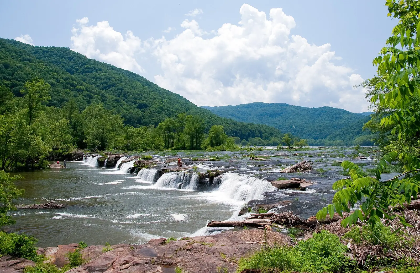
The park describes a rugged river that flows north, more than 70,000 acres, and the New River as one of the oldest on the continent. Sandstone Falls is the published fall inside the boundary used for this page, the current National Park and Preserve polygon. It has 392 reviews, which is more than many multi-fall parks' busiest single fall. The trail file distance is 390 feet one way.
The trip notes say the fall runs year-round and is strong in spring, and that there is no activity fee. The fee page agrees there is no entrance fee. Effort-to-reward, if the phrase means reviews per mile of walking, makes this an outlier: hundreds of reviews for a few hundred feet of boardwalk. That is a real pattern in the data, and it is a different pattern from Ramsey Cascades or the Mist Trail.
The falls on our maps
One fall. The distance is in feet in the source, which is why it looks nothing like a trail-mileage row.
Sandstone Falls
Raleigh County, West Virginia · nearest listed town Hinton (5.9 miles in a straight line)
- Trail
- Sandstone Falls Boardwalk
- Distance
- 390 feet one way (one way)
- Reviews
- 392 · 4.8 stars
- Flow timing
- Year-round; strong flow in spring
Side by side
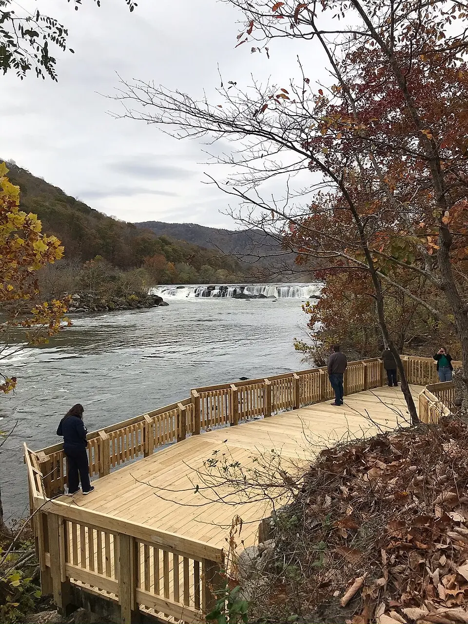
390 feet one way is the whole hike record. There is no elevation gain and no difficulty word.
| Waterfall | Distance | Elevation | Difficulty | USGS drop | Reviews | Flow note |
|---|---|---|---|---|---|---|
| Sandstone Falls | 390 feet one way | — | — | — | 392 | Year-round; strong flow in spring |
A dash means that field is not in the USGS gazetteer text, the trail file, or the hand-checked trip notes for that fall. It is not a claim that the number is zero.
Effort against attention
392 reviews divided by 390 feet is a huge reviews-per-mile number because the denominator is a boardwalk. Using that number to compare Sandstone Falls with a mountain trail in another park would be an abuse of the ratio. Inside this park there is no second fall to compare. The ratio is reported so the method stays visible, and then set aside.
Seeing more than one
The visit is the boardwalk: 390 feet one way. A second day of waterfall hiking is not in this dataset. The park has miles of river that are not waterfall pages on our site. Spring is the sourced "strong flow" season, and the notes also say the fall does not dry up in summer the way a Sierra wall fall does.
When the nearest gauge runs high
GREENBRIER RIVER AT HILLDALE, WV (USGS 03184000) sits 9.8 miles from Sandstone Falls. Across 2019–2024 the mean daily flow was highest in February (5,420 cfs) and lowest in October (453 cfs). The New River is the right water for this fall if the station is on the New River near Hinton or Sandstone. The spring bump in the trip notes should show up as a higher spring month. If the peak is elsewhere, the gauge and the trip note disagree and both stay on the page.
| Jan | Feb | Mar | Apr | May | Jun | Jul | Aug | Sep | Oct | Nov | Dec |
|---|---|---|---|---|---|---|---|---|---|---|---|
| 3,620 | 5,420 | 3,795 | 3,835 | 2,666 | 1,329 | 539 | 544 | 769 | 453 | 1,024 | 2,266 |
Fees, passes, and entry rules
No entrance fee, and the trip note says no activity fee at Sandstone.
- Entrance
- The fee page says the park does not charge an entrance fee. The Sandstone Falls trip note says there is no activity fee at this site.
Getting there
The NPS place page and the boardwalk thing-to-do are the access documents. Nothing in them, as stored in our trip file, describes a shuttle or a timed entry. Parking is the boardwalk lot, and the distance from the lot is the 390 feet.
What this park warns about
No hazard sentence specific to the boardwalk is in the trip file beyond the usual implication of a river overlook. None is added. The river description on the park homepage, whitewater in a deep canyon, is about the gorge as a whole and is not restated as a swimming warning for this overlook.
Small things the official pages mention
- No entrance fee. (NPS fees)
- Year-round flow, stronger in spring. Boardwalk is 390 feet one way. No activity fee. (NPS Sandstone Falls)
Towns our directory files these falls under
Hinton is the nearest city in our index, about 6 straight-line miles away. Hinton is the town at this end of the gorge.
- Hinton, WV — 1 of these falls, closest about 6 miles in a straight line
Photographs
How this page was built
The boardwalk length is converted to miles only inside the ratio, and the ratio is then flagged as misleading for cross-park comparison. Flow timing comes from the trip note, checked against the gauge if the station is actually on the New River. The boundary is the current park-and-preserve polygon, not the older "national river" label.
Sources
- NPS administrative boundaries
- New River Gorge National Park and Preserve
- NPS: New River Gorge fees
- NPS: Sandstone Falls
- NPS: Sandstone Falls boardwalk
- OpenStreetMap contributors (way 287982497)
- USGS 03184000 GREENBRIER RIVER AT HILLDALE, WV
- File:Sandstone Falls, WV (Lower Falls).jpg
- File:Keenys-Creek-Waterfalls.jpg
- File:New River Gorge Bridge Overlook.jpg
- File:The viewing deck at the end of the boardwalk offers outstanding views of Sandstone Falls. (0db13426-4851-4dc8-9043-750a1398b535).jpeg