
The park marks March 1, 1872 as the date it became the first national park. The eight waterfall pages inside the boundary are all in Wyoming in our directory. Review counts are not subtle: Mystic Falls has 706, the Upper Falls of the Yellowstone have 229, and Albright Falls has none. Most of the park sits at 6,000 feet or higher, and the weather page says snow is possible in every month.
Upper Falls carries the only sourced season line in this set: late spring and early summer for peak snowmelt, with the added note that park roads are seasonal. That sentence does not automatically describe Firehole Falls or Wraith Falls. They are separate coordinates.
The falls on our maps
Mystic Falls is the one busy fall with a round-trip distance. Wraith Falls is a short one-way figure. The canyon falls have the audiences and, in our files, no hike length.
Albright Falls
Teton County, Wyoming · nearest listed town Moose Wilson Road (52 miles in a straight line)
In Bechler Canyon, on an unnamed tributary of the Echler River, 6.4 km (4 mI0 SW of Douglas Knob.
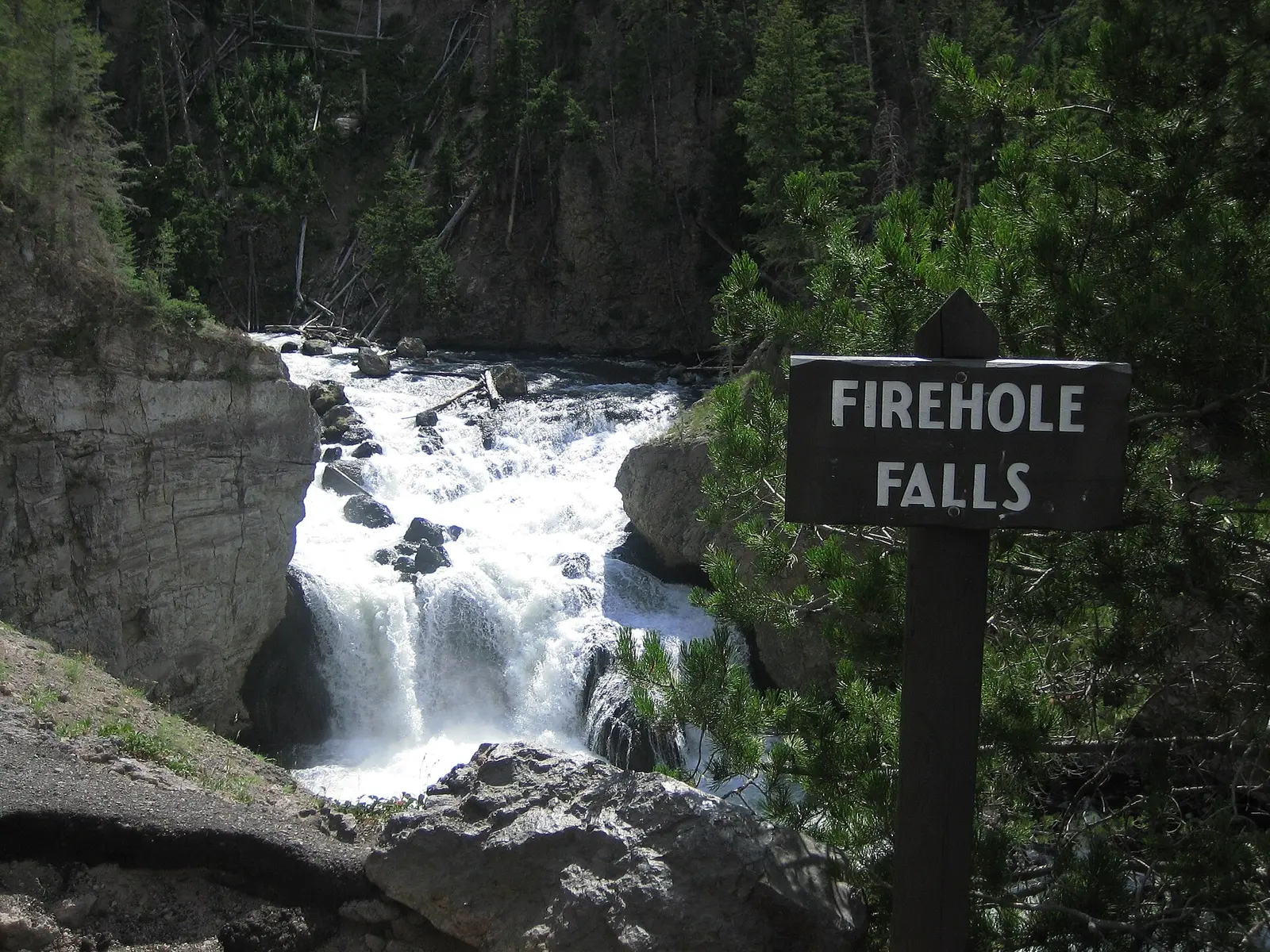
Firehole Falls
Teton County, Wyoming · nearest listed town Moose Wilson Road (76 miles in a straight line)
- Reviews
- 61 · 4.8 stars
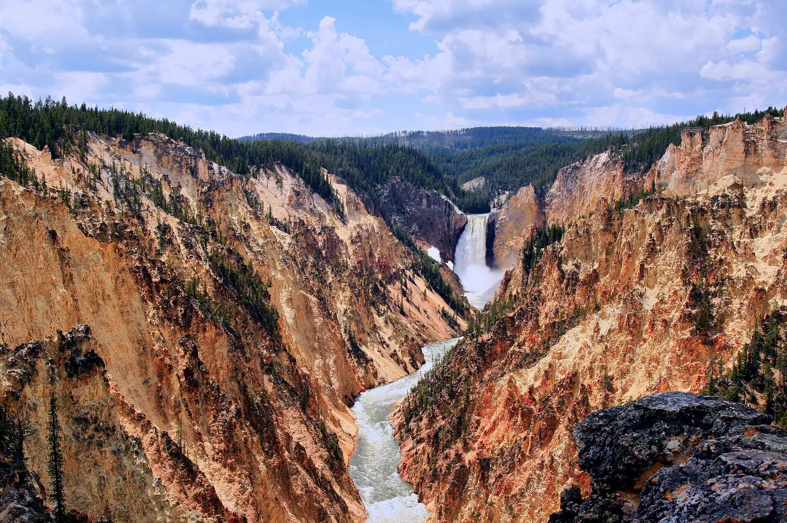
Lower Falls of the Yellowstone River
Park County, Wyoming · nearest listed town Cody (72 miles in a straight line)
- Reviews
- 77 · 4.9 stars
Moose Falls
Teton County, Wyoming · nearest listed town Moose Wilson Road (44 miles in a straight line)
- Reviews
- 40 · 4.9 stars
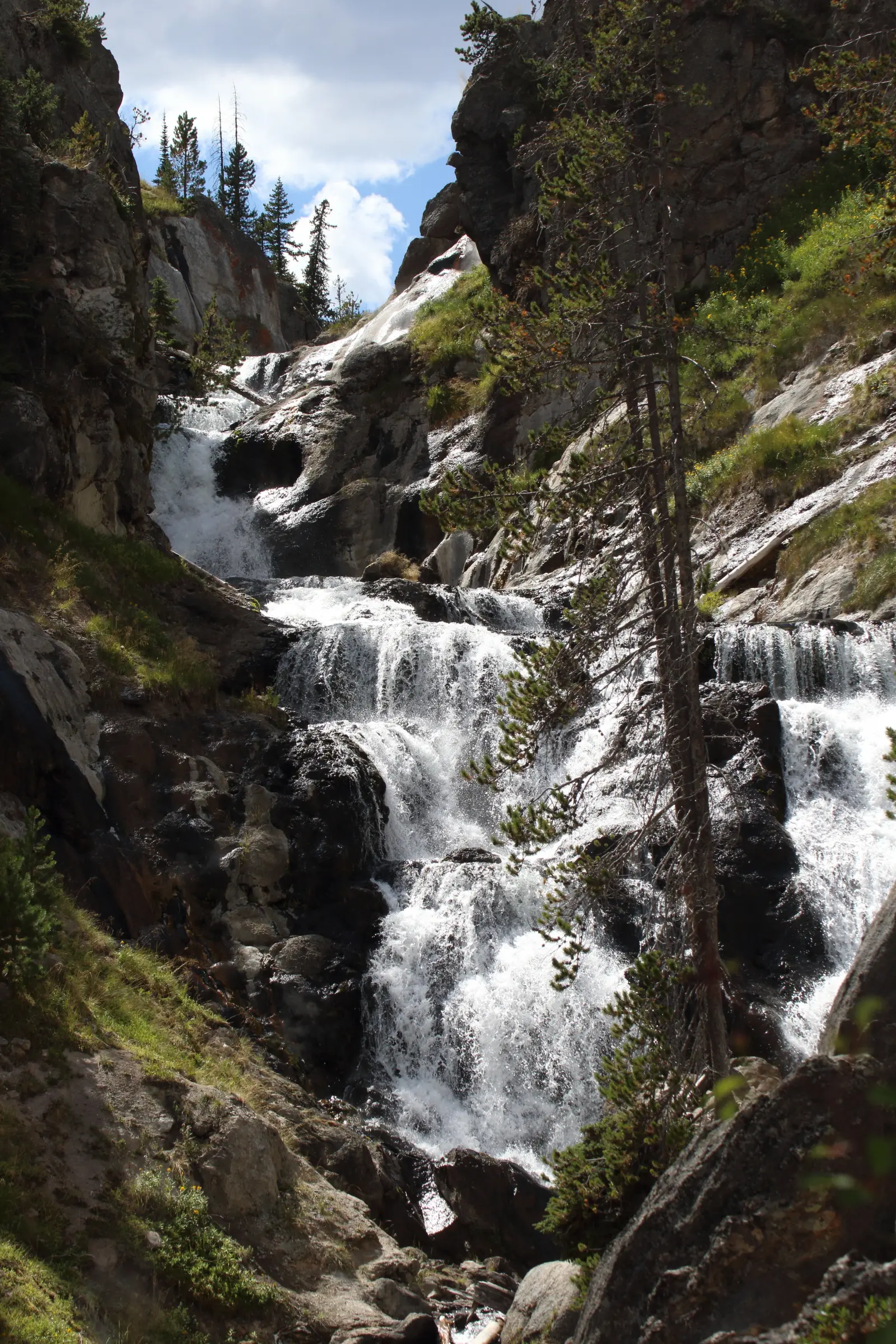
Mystic Falls
Teton County, Wyoming · nearest listed town Moose Wilson Road (66 miles in a straight line)
- Trail
- Mystic Falls Trail
- Distance
- 2.4 miles round trip (round trip)
- Elevation
- Modest to the falls; about 500 feet more if you climb to the overlook
- Difficulty
- Rated moderately strenuous by the park
- Reviews
- 706 · 4.6 stars
Undine Falls
Park County, Wyoming · nearest listed town Cody (83 miles in a straight line)
- Reviews
- 50 · 4.7 stars
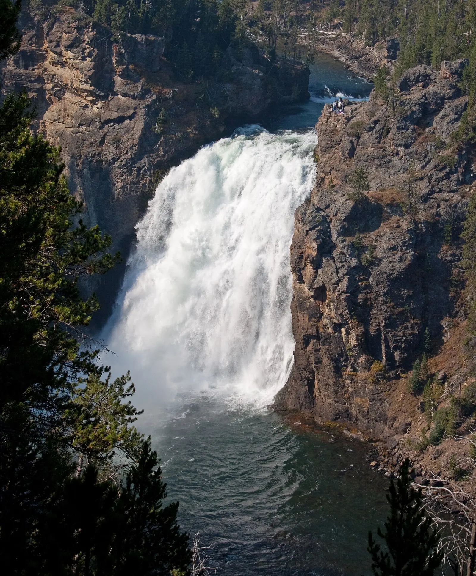
Upper Falls of the Yellowstone River
Park County, Wyoming · nearest listed town Cody (72 miles in a straight line)
- Reviews
- 229 · 4.8 stars
- Flow timing
- Late spring and early summer for peak snowmelt flow; park roads are seasonal
Wraith Falls
Park County, Wyoming · nearest listed town Cody (82 miles in a straight line)
- Trail
- Wraith Falls trail
- Distance
- 0.4 miles one way (one way)
- Reviews
- 26 · 4.5 stars
Side by side
The elevation cell for Mystic Falls is left blank on purpose. The trail note says "modest to the falls" and then a further climb to an overlook. That is not a single gain number, so it is not added to anything.
| Waterfall | Distance | Elevation | Difficulty | USGS drop | Reviews | Flow note |
|---|---|---|---|---|---|---|
| Albright Falls | — | — | — | — | — | — |
| Firehole Falls | — | — | — | — | 61 | — |
| Lower Falls of the Yellowstone River | — | — | — | — | 77 | — |
| Moose Falls | — | — | — | — | 40 | — |
| Mystic Falls | 2.4 miles round trip | Modest to the falls; about 500 feet more if you climb to the overlook | Rated moderately strenuous by the park | — | 706 | — |
| Undine Falls | — | — | — | — | 50 | — |
| Upper Falls of the Yellowstone River | — | — | — | — | 229 | Late spring and early summer for peak snowmelt flow; park roads are seasonal |
| Wraith Falls | 0.4 miles one way | — | — | — | 26 | — |
A dash means that field is not in the USGS gazetteer text, the trail file, or the hand-checked trip notes for that fall. It is not a claim that the number is zero.
Effort against attention
Only two of these falls have both reviews and a distance: Mystic Falls at 2.4 miles round trip with 706 reviews, and Wraith Falls at 0.4 miles one way with 26 reviews. Wraith's distance is one way. It is not doubled, so its reviews-per-mile number looks kinder than a round trip of the same path would. The canyon falls cannot enter the ratio. Ranking Yellowstone waterfalls by effort using only these two would hide the places people actually write about.
Albright Falls is the other gap. USGS puts it in Bechler Canyon, on a tributary of the Fall River drainage, named for the park's first civilian superintendent. There is no trail length and no review count. It is inside the boundary and that is why it is listed. It is not a roadside stop in this data.
- Mystic Falls: 706 reviews ÷ 2.4 miles = 294 reviews per published mile (round trip).
- Wraith Falls: 26 reviews ÷ 0.4 miles = 65 reviews per published mile (one way).
Seeing more than one
A sourced short walk is Wraith Falls, 0.4 miles one way. A sourced half-day with a difficulty word attached is Mystic Falls, 2.4 miles round trip, called moderately strenuous by the park, with a modest climb to the falls and more if you continue to the overlook. Those are two different basins. The straight-line chain is Undine Falls, Wraith Falls, Lower Falls of the Yellowstone River, Upper Falls of the Yellowstone River, Firehole Falls, Mystic Falls, Albright Falls, Moose Falls. Do not read that list as a driving loop.
There is no honest two-day waterfall itinerary that visits every named fall here, because five of the eight have no hike length: Albright Falls, Firehole Falls, Lower Falls of the Yellowstone River, Moose Falls, Undine Falls, Upper Falls of the Yellowstone River. The summed distances we do have are 2.8 miles. Upper Falls is the one with a season: go in late spring or early summer for snowmelt, and expect the road to that overlook to be a seasonal road.
When the nearest gauge runs high
Gibbon River at Madison Jct, YNP (USGS 06037100) sits 0.7 miles from Firehole Falls. Across 2019–2024 the mean daily flow was highest in May (247 cfs) and lowest in February (87 cfs). A Yellowstone River gauge, if that is the station chosen, speaks for the canyon falls more than for Firehole Falls or a Bechler tributary. Read the station name before treating the month as parkwide.
| Jan | Feb | Mar | Apr | May | Jun | Jul | Aug | Sep | Oct | Nov | Dec |
|---|---|---|---|---|---|---|---|---|---|---|---|
| 89 | 87 | 89 | 115 | 247 | 211 | 113 | 102 | 96 | 94 | 94 | 88 |
Fees, passes, and entry rules
Entrance is required. A vehicle reservation is not. Non-US residents pay an added per-person fee on this park's 2026 fee page.
- Private vehicle
- $35 for seven consecutive days. The vehicle must be private, non-commercial, and seat 15 or fewer.
- On foot, bicycle, or skis
- $20 for visitors 16 and older.
- Motorcycle or snowmobile
- $30 for seven days, up to two machines and four people.
- Non-US residents
- $100 per person age 16 and older, added to the standard entrance fee, unless admitted with an annual or America the Beautiful pass.
- Vehicle reservation
- The fee page says an entrance pass is required and vehicle reservations are not.
Getting there
Passes can be bought before arrival or at an entrance station. The weather page's practical point for waterfall timing is elevation: daytime spring and fall temperatures often sit between the teens and the 60s, with a foot of snow in a day not treated as unusual.
What this park warns about
The Mystic Falls trip note is the specific one: the park rates the trail moderately strenuous. Upper Falls adds seasonal roads. Neither note is a substitute for the park's thermal-area rules, which this waterfall file does not restate because they are not attached to these eight records.
Small things the official pages mention
- Vehicle reservations are not required. An entrance pass is. (NPS Yellowstone fees)
- Upper Falls: late spring and early summer for peak snowmelt, and park roads are seasonal. (NPS Grand Canyon of the Yellowstone)
Towns our directory files these falls under
The directory files the Bechler and Firehole and Mystic names under Moose Wilson Road, and the canyon and Wraith and Undine names under Cody. Cody is the nearest city of 1,000 people in our file for those coordinates, which is not the same thing as the nearest parking lot.
- Moose Wilson Road, WY — 4 of these falls, closest about 44 miles in a straight line
- Cody, WY — 4 of these falls, closest about 72 miles in a straight line
Photographs
How this page was built
The ratio only includes falls with both a review count and a parsed distance. Mystic's elevation text is excluded from any elevation sum because it is not a single number. One-way distances are not doubled. The coordinate order is a straight-line chain from the northernmost fall.
Sources
- NPS administrative boundaries
- Yellowstone National Park
- NPS: Yellowstone fees
- NPS: Grand Canyon of the Yellowstone
- NPS: Mystic Falls trail
- NPS: Biscuit Basin Trailhead
- OpenStreetMap contributors (way 91020372)
- OpenStreetMap contributors (way 24251343)
- USGS 06037100 Gibbon River at Madison Jct, YNP
- File:Grand canyon of Yellowstone and Yellowstone fall nn edit1.jpg
- File:Grand Canyon of the Yellowstone Upper Falls (8044053340).jpg
- File:Firehole Falls, Yellowstone National Park Picture 1200.jpg
- File:Mystic Falls Yellowstone.JPG