
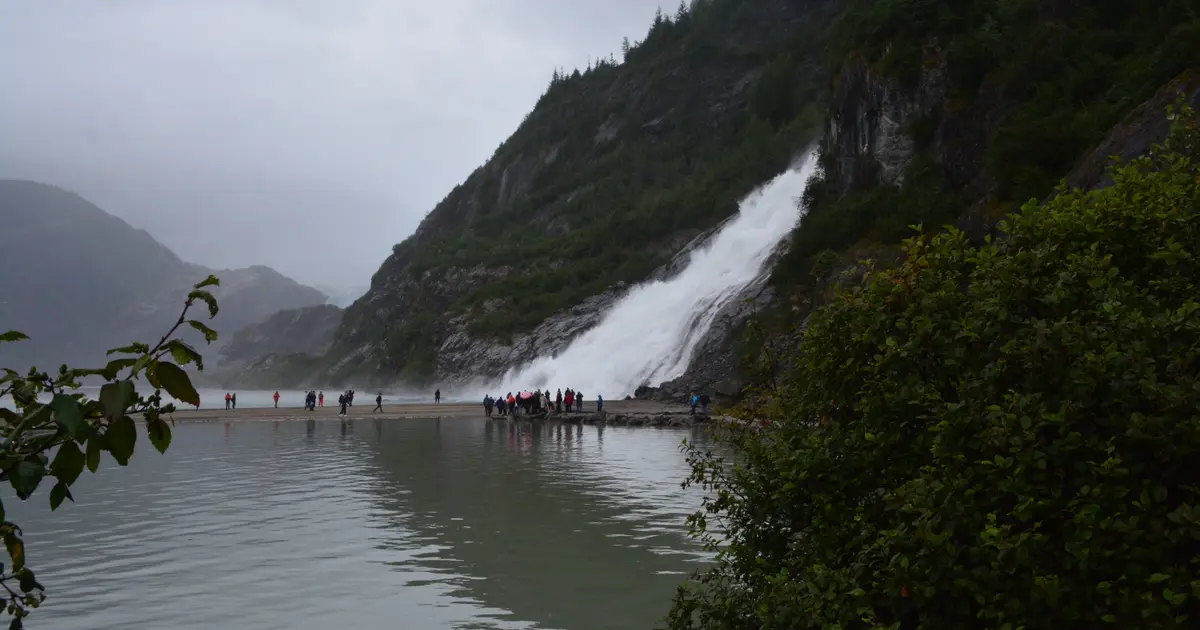

Alaska has 46 named waterfalls in the U.S. Geological Survey Geographic Names Information System, the features classified as Falls. That count ranks Alaska 17th among the 50 states. The figure comes from the GNIS domestic-names extract in this site, committed 2026-10-02, and this page was published 2026-11-19. The latest feature-edit date stored on these Falls records is December 30, 2020.
National rank and density
Divided by the state's land area of 571,242 square miles, from the U.S. Census Bureau 2024 Gazetteer (ALAND_SQMI, land only, inland water excluded), Alaska has 0.08 named falls per 1,000 square miles. That density ranks 43rd of the 50 states. The national named total in this extract is 2,514 falls across the 50 states, so Alaska holds 1.8 percent of them.
Alaska shares no land boundary with another state. The right comparison is the national rank above, not a neighbor.
Where the named falls cluster
Alaska's named falls are filed under 19 county equivalents. The largest counts are Chugach (6), Juneau (6), and Prince of Wales-Hyder (CA) (5), 17 falls and 37 percent of the state total.
The Alaska waterfall map plots the same named falls. County names are the labels GNIS recorded. Connecticut's file uses planning regions, Alaska's uses boroughs and census areas, and Louisiana's uses parishes, so the column is not always a traditional county.
| County or equivalent | Named falls | Share | Examples |
|---|---|---|---|
| Chugach | 6 | 13% | Bridal Veil Falls, Horsetail Falls, Ohman Falls |
| Juneau | 6 | 13% | Alaska Chief Falls, Ebner Falls, Grindstone Falls |
| Prince of Wales-Hyder (CA) | 5 | 10.9% | Nutkwa Falls, Silver Falls, Silver Salmon Falls |
| Hoonah-Angoon (CA) | 4 | 8.7% | Lax'áask'i, Tax'áas, The Falls |
| Bethel | 3 | 6.5% | Golden Gate Falls, Lower Falls, Upper Falls |
| Copper River | 3 | 6.5% | Cheshnina Falls, Chitistone Falls, Liberty Falls |
| Lake and Peninsula | 3 | 6.5% | Brooks Falls, Petrof Falls, Wolverine Falls |
| Skagway | 3 | 6.5% | Bridal Veil Falls, Pitchfork Falls, Reid Falls |
| Ketchikan Gateway | 2 | 4.3% | Beaver Falls, Fish Ladder |
| Sitka | 2 | 4.3% | Hidden Falls, Kasnyku Falls |
| Aleutians West (CA) | 1 | 2.2% | White Falls |
| Anchorage | 1 | 2.2% | Thunder Bird Falls |
| Dillingham | 1 | 2.2% | Tikchik Falls |
| Dillingham (CA) | 1 | 2.2% | Kolevokharit Koygut Falls |
| Kenai Peninsula | 1 | 2.2% | Cynthia Falls |
| Kodiak Island | 1 | 2.2% | Fultons Falls |
| Matanuska-Susitna | 1 | 2.2% | Rotary Falls |
| Southeast Fairbanks (CA) | 1 | 2.2% | The Falls |
| Wrangell | 1 | 2.2% | Rainbow Falls |
Why Alaska's count looks like this
Alaska has fewer named falls than Maine, which is the opposite of what the relief suggests. Juneau and the Chugach census area lead a short list. The coast ranges fall straight into fjords, glaciers leave hanging valleys, and the rain is heavy. The gazetteer still records only a few dozen names because most of those drops were never named in a federal file. A count of named features measures mapping and settlement as well as geology.
What is named clusters on the road and ferry system: Juneau, the Chugach, Prince of Wales, Skagway. The Alaska Range and the Brooks Range are full of unnamed water and almost empty of Falls-class records. Katmai National Park has published pages where a named fall happens to sit inside the boundary. That is a handful of records, not a statewide inventory.
Named falls we publish
We publish a full page for 17 of the 46 named falls. A page exists when the fall has at least 25 Google reviews, a sourced trip guide, or at least 200 characters of USGS description or history. The other 29 stay on the state guide as names and coordinates. The Alaska state guide also lists 2 other places from Google Maps that are not in the GNIS Falls extract, so the guide's total is 48.
- Bridal Veil Falls (Chugach · 49 Google reviews)
- Horsetail Falls (Chugach · 36 Google reviews)
- Thunder Bird Falls (Anchorage · 26 Google reviews)
- Reid Falls (Skagway · 25 Google reviews · Lower Reid Falls Trail)
- Brooks Falls (Lake and Peninsula · 21 Google reviews)
- Ebner Falls (Juneau · 6 Google reviews)
- Hidden Falls (Sitka · 1 Google reviews)
- Tikchik Falls (Dillingham · 1 Google reviews)
- Alaska Chief Falls (Juneau)
- Beaver Falls (Ketchikan Gateway)
- Cynthia Falls (Kenai Peninsula)
- Fultons Falls (Kodiak Island)
Those are the 12 published pages with the most Google reviews. The state guide links the rest.
Tallest falls on the record
The national roundup, the largest waterfalls in the U.S. by state, does not name a single well-documented tallest waterfall for Alaska. Separately, the tallest height written into the USGS gazetteer text in our file is Rotary Falls at 100 feet. Most Falls records state no height, so this is not a ranking of the tallest waterfall in the state.
National parks
These national park guides include a published waterfall whose coordinates fall inside the park and inside Alaska.
- Katmai National Park (3 published waterfalls in Alaska: Brooks Falls, Fultons Falls, Wolverine Falls)
Trails we can measure
These distances come from the trail notes already attached to the published pages, either a sourced trip guide or an OpenStreetMap path. A blank distance means the map did not give one we were willing to print.
- Reid Falls: Lower Reid Falls Trail
When to go in Alaska
The practical season is late May into September. Southcentral snowmelt is strongest in late May and June. Glacier-fed creeks keep running later, and they are silty and extremely cold. Coastal trails around Juneau can be raining in any of those months. Outside that window, roads, ferries and daylight all get harder, and a named fall you cannot reach does not belong on a weekend plan.
How this number was counted
Named falls are records with feature class Falls in the USGS National Map GNIS domestic names, filtered to this state in data/gnis-waterfalls.json. The download script is scripts/prepare-gnis.mjs, pointed at the USGS domestic-names file. Land area is ALAND_SQMI in the Census Bureau 2024 Gazetteer national state file, written by scripts/prepare-state-areas.mjs. Density is named falls divided by land area, times 1,000. The full 50-state ranking, including states with too few named falls for their own page, is Which state has the most waterfalls?.
Frequently asked questions
How many waterfalls are in Alaska?
Alaska has 46 named waterfalls in the USGS GNIS Falls class, ranking 17th of the 50 states. The extract used here was committed 2026-10-02, and this page was published 2026-11-19.
Which county in Alaska has the most named waterfalls?
Chugach has the most, with 6 named falls. Juneau is next with 6.
How many Alaska waterfalls have a page on this site?
17 of the 46 named falls have a published page. A page requires 25 or more Google reviews, a sourced trip guide, or at least 200 characters of USGS description or history.
When is the best time to see waterfalls in Alaska?
The practical season is late May into September. Southcentral snowmelt is strongest in late May and June. Glacier-fed creeks keep running later, and they are silty and extremely cold. Coastal trails around Juneau can be raining in any of those months. Outside that window, roads, ferries and daylight all get harder, and a named fall you cannot reach does not belong on a weekend plan.
Why doesn’t Alaska have the most named waterfalls?
Because this ranking counts names in the USGS Falls class, not every drop in the mountains. Alaska’s coast ranges and glaciers produce vast numbers of falls that were never entered as a named feature. The named list is short and clustered on the accessible coast.