
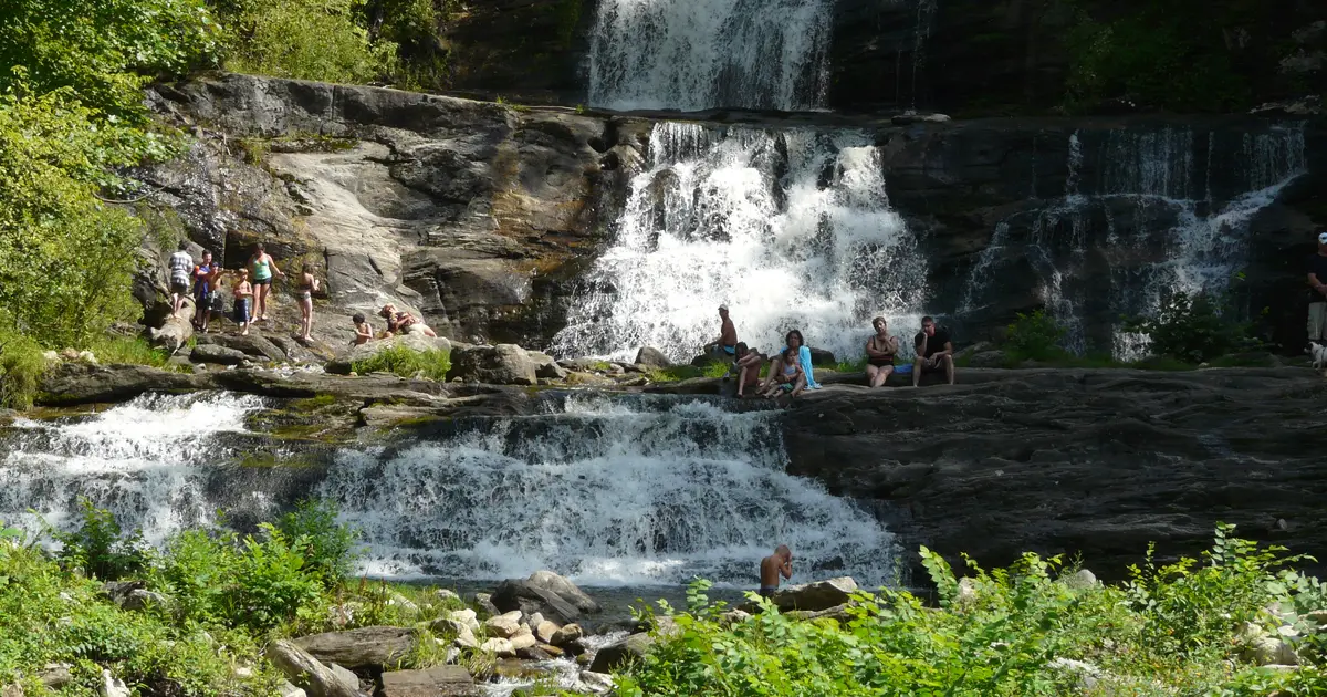

Connecticut has 11 named waterfalls in the U.S. Geological Survey Geographic Names Information System, the features classified as Falls. That count ranks Connecticut tied for 35th with Maryland among the 50 states. The figure comes from the GNIS domestic-names extract in this site, committed 2026-10-02, and this page was published 2026-11-19. The latest feature-edit date stored on these Falls records is December 30, 2020.
National rank and density
Divided by the state's land area of 4,842 square miles, from the U.S. Census Bureau 2024 Gazetteer (ALAND_SQMI, land only, inland water excluded), Connecticut has 2.27 named falls per 1,000 square miles. That density ranks 11th of the 50 states. The national named total in this extract is 2,514 falls across the 50 states, so Connecticut holds 0.4 percent of them.
Bordering states, with their named-falls counts: Massachusetts (26); New York (215); Rhode Island (5, no separate count page).
Where the named falls cluster
Connecticut's named falls are filed under 5 county equivalents. The largest counts are Southeastern Connecticut (4), Lower Connecticut River Valley (3), and Northwest Hills (2), 9 falls and 81.8 percent of the state total.
The Connecticut waterfall map plots the same named falls. County names are the labels GNIS recorded. Connecticut's file uses planning regions, Alaska's uses boroughs and census areas, and Louisiana's uses parishes, so the column is not always a traditional county.
| County or equivalent | Named falls | Share | Examples |
|---|---|---|---|
| Southeastern Connecticut | 4 | 36.4% | Quinebaug Falls, Shetucket Falls, Silver Falls |
| Lower Connecticut River Valley | 3 | 27.3% | Chapman Falls, Wadsworth Falls, Westfield Falls |
| Northwest Hills | 2 | 18.2% | Great Falls, Roxbury Falls |
| Naugatuck Valley | 1 | 9.1% | Buttermilk Falls |
| Western Connecticut | 1 | 9.1% | Rippowan Falls |
Every named fall in the extract:
| Name | County or equivalent | On this site |
|---|---|---|
| Buttermilk Falls | Naugatuck Valley | Published page |
| Chapman Falls | Lower Connecticut River Valley | Published page |
| Great Falls | Northwest Hills | Published page |
| Quinebaug Falls | Southeastern Connecticut | Listed on the state guide |
| Rippowan Falls | Western Connecticut | Listed on the state guide |
| Roxbury Falls | Northwest Hills | Listed on the state guide |
| Shetucket Falls | Southeastern Connecticut | Listed on the state guide |
| Silver Falls | Southeastern Connecticut | Listed on the state guide |
| Wadsworth Falls | Lower Connecticut River Valley | Published page |
| Westfield Falls | Lower Connecticut River Valley | Published page |
| Yantic Falls | Southeastern Connecticut | Published page |
Why Connecticut's count looks like this
Connecticut’s names are glacial steps on old crystalline rock. The state is schist, gneiss and granite, with a sandstone central lowland, and the ice sheet left ledges that brooks still fall over. GNIS files several of them under planning-region names rather than the old eight counties. Southeastern Connecticut is the label with the most records, then the Lower Connecticut River Valley. The counts are small either way.
The western uplands, toward the Berkshires, are steeper and hold some of the better-known drops, and they do not dominate the file the way Berkshire County dominates Massachusetts. Eleven named falls is a real list. It is not a region you can spend a week driving between. Several of the published pages are short walks to a single ledge.
Named falls we publish
We publish a full page for 6 of the 11 named falls. A page exists when the fall has at least 25 Google reviews, a sourced trip guide, or at least 200 characters of USGS description or history. The other 5 stay on the state guide as names and coordinates. The Connecticut state guide lists these same named falls.
- Yantic Falls (Southeastern Connecticut · 122 Google reviews)
- Chapman Falls (Lower Connecticut River Valley · 118 Google reviews)
- Great Falls (Northwest Hills · 100 Google reviews)
- Westfield Falls (Lower Connecticut River Valley · 94 Google reviews)
- Wadsworth Falls (Lower Connecticut River Valley · 86 Google reviews)
- Buttermilk Falls (Naugatuck Valley · 80 Google reviews)
Tallest falls on the record
The national roundup, the largest waterfalls in the U.S. by state, does not name a single well-documented tallest waterfall for Connecticut. None of the USGS descriptions in our file state a height in feet for a named fall here. We do not estimate one.
National parks
None of the national park guides on this site currently include a published waterfall inside Connecticut. Named falls here are on other public or private land. The state guide is the place to check access. We do not assign falls to a national forest unless a park boundary in our file contains them.
When to go in Connecticut
Late March into May is the peak, snowmelt off the western hills plus spring rain, before the canopy closes. Early summer is still reasonable after a wet spring. By August the smaller ledges need a recent rain. Fall color in mid-October is a reason to walk the same short trails on lower water. Winter ice on the shaded ledges is common and the approaches are not long.
How this number was counted
Named falls are records with feature class Falls in the USGS National Map GNIS domestic names, filtered to this state in data/gnis-waterfalls.json. The download script is scripts/prepare-gnis.mjs, pointed at the USGS domestic-names file. Land area is ALAND_SQMI in the Census Bureau 2024 Gazetteer national state file, written by scripts/prepare-state-areas.mjs. Density is named falls divided by land area, times 1,000. The full 50-state ranking, including states with too few named falls for their own page, is Which state has the most waterfalls?.
Frequently asked questions
How many waterfalls are in Connecticut?
Connecticut has 11 named waterfalls in the USGS GNIS Falls class, ranking tied for 35th with Maryland of the 50 states. The extract used here was committed 2026-10-02, and this page was published 2026-11-19.
Which county in Connecticut has the most named waterfalls?
Southeastern Connecticut has the most, with 4 named falls. Lower Connecticut River Valley is next with 3.
How many Connecticut waterfalls have a page on this site?
6 of the 11 named falls have a published page. A page requires 25 or more Google reviews, a sourced trip guide, or at least 200 characters of USGS description or history.
When is the best time to see waterfalls in Connecticut?
Late March into May is the peak, snowmelt off the western hills plus spring rain, before the canopy closes. Early summer is still reasonable after a wet spring. By August the smaller ledges need a recent rain. Fall color in mid-October is a reason to walk the same short trails on lower water. Winter ice on the shaded ledges is common and the approaches are not long.
Why do Connecticut’s waterfall counties have unfamiliar names?
GNIS records several of them under the state’s planning regions, such as Southeastern Connecticut and the Lower Connecticut River Valley, rather than under the eight traditional counties. The named falls are real. The geographic labels in the file are the modern county equivalents.