
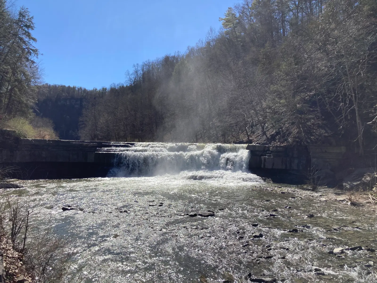

New York has 215 named waterfalls in the U.S. Geological Survey Geographic Names Information System, the features classified as Falls. That count ranks New York 2nd among the 50 states. The figure comes from the GNIS domestic-names extract in this site, committed 2026-10-02, and this page was published 2026-11-19. The latest feature-edit date stored on these Falls records is December 30, 2020.
National rank and density
Divided by the state's land area of 47,123 square miles, from the U.S. Census Bureau 2024 Gazetteer (ALAND_SQMI, land only, inland water excluded), New York has 4.56 named falls per 1,000 square miles. That density ranks 4th of the 50 states. The national named total in this extract is 2,514 falls across the 50 states, so New York holds 8.6 percent of them.
Bordering states, with their named-falls counts: Connecticut (11); Massachusetts (26); New Jersey (6, no separate count page); Pennsylvania (91); Vermont (29).
Where the named falls cluster
New York's named falls are filed under 42 county equivalents. The largest counts are St. Lawrence (41), Essex (22), and Lewis (13), 76 falls and 35.3 percent of the state total.
St. Lawrence County has 41 named falls. The eight Finger Lakes counties used here (Tompkins, Schuyler, Seneca, Yates, Ontario, Cayuga, Steuben and Chemung) have 17 combined.
The New York waterfall map plots the same named falls. County names are the labels GNIS recorded. Connecticut's file uses planning regions, Alaska's uses boroughs and census areas, and Louisiana's uses parishes, so the column is not always a traditional county.
Why New York's count looks like this
New York is second, and the reason is not Niagara. St. Lawrence County alone holds the state’s biggest block of named falls, with Essex County next, along the Adirondack side. The Finger Lakes gorges that visitors drive to, Taughannock, Ithaca, Watkins Glen, are real and spectacular, and they are a smaller share of the named count than the northern counties.
Ice did the rearranging. The last ice sheet gouged the Finger Lakes troughs, left side streams hanging, and scraped the Adirondack and Tug Hill uplands down to ledges. Streams then cut those ledges into the glens and flumes that dominate the gazetteer. Niagara is a different object: a high-volume river on a dolomite cap, one complex rather than a crowd of named creeks. Treat “most waterfalls” and “largest waterfall” as separate questions. New York can be near the top of both, for different reasons.
Named falls we publish
We publish a full page for 54 of the 215 named falls. A page exists when the fall has at least 25 Google reviews, a sourced trip guide, or at least 200 characters of USGS description or history. The other 161 stay on the state guide as names and coordinates. The New York state guide also lists 6 other places from Google Maps that are not in the GNIS Falls extract, so the guide's total is 221.
- Kaaterskill Falls (Greene · 1,560 Google reviews · 0.3 mile one way)
- Ithaca Falls (Tompkins · 664 Google reviews · About 0.1 mile one way)
- Taughannock Falls (Tompkins · 367 Google reviews · About 0.75 mile one way (1.5 miles round trip))
- Salmon River Falls (Oswego · 344 Google reviews · 0.2 mile one way)
- American Falls (Niagara · 298 Google reviews)
- Shequaga Falls (Schuyler · 200 Google reviews)
- Niagara Falls (Niagara · 185 Google reviews)
- Cohoes Falls (Saratoga · 157 Google reviews)
- Hector Falls (Schuyler · 148 Google reviews)
- Lucifer Falls (Tompkins · 144 Google reviews)
- Carpenter Falls (Cayuga · 131 Google reviews)
- Split Rock Falls (Essex · 126 Google reviews)
Those are the 12 published pages with the most Google reviews. The state guide links the rest.
Tallest falls on the record
Our national roundup, the largest waterfalls in the U.S. by state, names a well-documented tall fall for New York in the state-by-state table. That roundup is a height and volume study. It is not this named-count ranking. Separately, the tallest height written into the USGS gazetteer text in our file is Verkeerder Kill Falls at 187 feet, High Falls at 150 feet, and Cohoes Falls at 90 feet. Most Falls records state no height, so this is not a ranking of the tallest waterfall in the state. For volume rather than height, the same roundup covers Niagara in the largest-by-volume section.
National parks
None of the national park guides on this site currently include a published waterfall inside New York. Named falls here are on other public or private land. The state guide is the place to check access. We do not assign falls to a national forest unless a park boundary in our file contains them.
Trails we can measure
These distances come from the trail notes already attached to the published pages, either a sourced trip guide or an OpenStreetMap path. A blank distance means the map did not give one we were willing to print.
- Kaaterskill Falls: Kaaterskill Falls Trail, 0.3 mile one way
- Ithaca Falls: About 0.1 mile one way
- Taughannock Falls: Gorge Trail, About 0.75 mile one way (1.5 miles round trip)
- Salmon River Falls: Accessible Falls Trail, 0.2 mile one way
- Stony Kill Falls: Stony Kill Carriage Road
- Auger Falls: Auger Falls Trail
When to go in New York
Creek falls across the state usually look strongest from snowmelt and spring rain, roughly late March into May, before the forest canopy closes. Gorge trails in the Finger Lakes can be icy in early spring and closed when rock is unstable. Niagara runs all year because the river is regulated, not because of local snowpack. Adirondack brooks stay high later than the Hudson Valley.
How this number was counted
Named falls are records with feature class Falls in the USGS National Map GNIS domestic names, filtered to this state in data/gnis-waterfalls.json. The download script is scripts/prepare-gnis.mjs, pointed at the USGS domestic-names file. Land area is ALAND_SQMI in the Census Bureau 2024 Gazetteer national state file, written by scripts/prepare-state-areas.mjs. Density is named falls divided by land area, times 1,000. The full 50-state ranking, including states with too few named falls for their own page, is Which state has the most waterfalls?.
Frequently asked questions
How many waterfalls are in New York?
New York has 215 named waterfalls in the USGS GNIS Falls class, ranking 2nd of the 50 states. The extract used here was committed 2026-10-02, and this page was published 2026-11-19.
Which county in New York has the most named waterfalls?
St. Lawrence has the most, with 41 named falls. Essex is next with 22.
How many New York waterfalls have a page on this site?
54 of the 215 named falls have a published page. A page requires 25 or more Google reviews, a sourced trip guide, or at least 200 characters of USGS description or history.
When is the best time to see waterfalls in New York?
Creek falls across the state usually look strongest from snowmelt and spring rain, roughly late March into May, before the forest canopy closes. Gorge trails in the Finger Lakes can be icy in early spring and closed when rock is unstable. Niagara runs all year because the river is regulated, not because of local snowpack. Adirondack brooks stay high later than the Hudson Valley.
Is New York’s waterfall count mostly Niagara and the Finger Lakes?
No. Niagara is a single high-volume complex, and the famous Finger Lakes gorges are a modest share of the named list. St. Lawrence County has the most named falls in the state, and Essex County is second. The count is a northern and Adirondack story as much as a gorge-tourism story.