
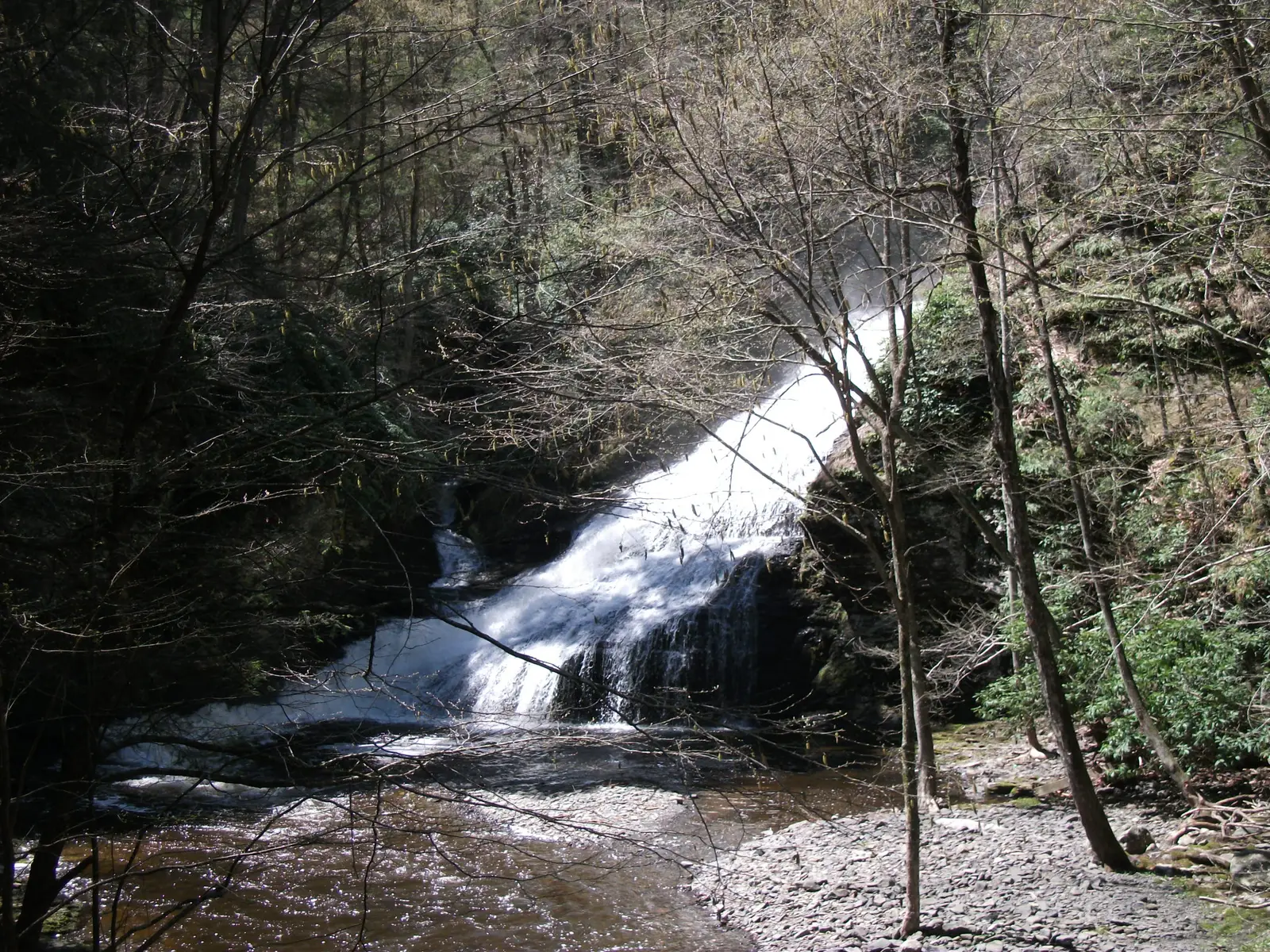

Pennsylvania has 91 named waterfalls in the U.S. Geological Survey Geographic Names Information System, the features classified as Falls. That count ranks Pennsylvania 10th among the 50 states. The figure comes from the GNIS domestic-names extract in this site, committed 2026-10-02, and this page was published 2026-11-19. The latest feature-edit date stored on these Falls records is December 30, 2020.
National rank and density
Divided by the state's land area of 44,742 square miles, from the U.S. Census Bureau 2024 Gazetteer (ALAND_SQMI, land only, inland water excluded), Pennsylvania has 2.03 named falls per 1,000 square miles. That density ranks 13th of the 50 states. The national named total in this extract is 2,514 falls across the 50 states, so Pennsylvania holds 3.6 percent of them.
Bordering states, with their named-falls counts: Delaware (0, no separate count page); Maryland (11); New Jersey (6, no separate count page); New York (215); Ohio (18); West Virginia (16).
Where the named falls cluster
Pennsylvania's named falls are filed under 23 county equivalents. The largest counts are Luzerne (25), Pike (14), and Monroe (13), 52 falls and 57.1 percent of the state total.
The Pennsylvania waterfall map plots the same named falls. County names are the labels GNIS recorded. Connecticut's file uses planning regions, Alaska's uses boroughs and census areas, and Louisiana's uses parishes, so the column is not always a traditional county.
| County or equivalent | Named falls | Share | Examples |
|---|---|---|---|
| Luzerne | 25 | 27.5% | Adams Falls, B Reynolds Falls, Cayuga Falls |
| Pike | 14 | 15.4% | Bushkill Falls, Deer Leap Falls, Dingmans Falls |
| Monroe | 13 | 14.3% | Buck Hill Falls, Buttermilk Falls, Clarke Falls |
| Sullivan | 9 | 9.9% | Angel Falls, Buttermilk Falls, Cold Run Road Falls |
| Fayette | 5 | 5.5% | Creek Falls, Cucumber Falls, Jonathan Run Falls |
| Lawrence | 3 | 3.3% | Grant City Falls, Quakertown Falls, Spillway Falls |
| Wayne | 3 | 3.3% | Bucks Falls, Darbytown Falls, Wangum Falls |
| Cambria | 2 | 2.2% | White Tail Falls, Winding Staircase Falls |
| Philadelphia | 2 | 2.2% | Falls of Schuylkill, The Grotto |
| Somerset | 2 | 2.2% | Cole Run Falls, Laurel Falls |
| Beaver | 1 | 1.1% | Homewood Falls |
| Bucks | 1 | 1.1% | Scudders Falls |
| Carbon | 1 | 1.1% | Hawk Falls |
| Crawford | 1 | 1.1% | Rock Creek Falls |
| Dauphin | 1 | 1.1% | Conewago Falls |
| Erie | 1 | 1.1% | Howard Falls |
| Lackawanna | 1 | 1.1% | Nay Aug Falls |
| Lancaster | 1 | 1.1% | Conewago Falls |
| Mercer | 1 | 1.1% | Springfield Falls |
| Schuylkill | 1 | 1.1% | Tomhicken Falls |
| Tioga | 1 | 1.1% | Fallbrook Falls |
| Westmoreland | 1 | 1.1% | Adams Falls |
| Wyoming | 1 | 1.1% | Buttermilk Falls |
Why Pennsylvania's count looks like this
Pennsylvania’s named falls cluster in the glaciated northeast. Luzerne County leads, then Pike and Monroe, the Pocono plateau where the last ice sheet stopped, deranged the drainage, and left creeks falling off the sandstone edge of the Allegheny Plateau. Ricketts Glen, Dingmans and Bushkill are the visited version of that geology. The gazetteer has many more names in the same counties that never became a park brochure.
South and west of the glacial limit the plateau is still dissected, but the falls are fewer. The Youghiogheny at Ohiopyle is a river rapid and drop in Fayette County, a different kind of feature from a Pocono glen. The state’s rank, tenth, comes from the northeast counties, not from a statewide carpet of falls.
Named falls we publish
We publish a full page for 21 of the 91 named falls. A page exists when the fall has at least 25 Google reviews, a sourced trip guide, or at least 200 characters of USGS description or history. The other 70 stay on the state guide as names and coordinates. The Pennsylvania state guide also lists 4 other places from Google Maps that are not in the GNIS Falls extract, so the guide's total is 95.
- Bushkill Falls (Pike · 1,478 Google reviews)
- Dingmans Falls (Pike · 619 Google reviews · Dingmans Creek Trail)
- Hawk Falls (Carbon · 375 Google reviews · About 1.2 miles round trip)
- Cucumber Falls (Fayette · 314 Google reviews · About 1 mile one way)
- Raymondskill Falls (Pike · 310 Google reviews · 0.3 mile loop)
- Marshalls Falls (Monroe · 118 Google reviews)
- Ohiopyle Falls (Fayette · 90 Google reviews)
- Quakertown Falls (Lawrence · 89 Google reviews)
- Cole Run Falls (Somerset · 64 Google reviews · 760 feet one way)
- Nay Aug Falls (Lackawanna · 57 Google reviews)
- Adams Falls (Westmoreland · 55 Google reviews · Adam Falls Trail)
- Creek Falls (Fayette · 51 Google reviews)
Those are the 12 published pages with the most Google reviews. The state guide links the rest.
Tallest falls on the record
The national roundup, the largest waterfalls in the U.S. by state, does not name a single well-documented tallest waterfall for Pennsylvania. Separately, the tallest height written into the USGS gazetteer text in our file is Dingmans Falls at 130 feet, Silverthread Falls at 80 feet, and Harrison Wright Falls at 27 feet. Most Falls records state no height, so this is not a ranking of the tallest waterfall in the state.
National parks
None of the national park guides on this site currently include a published waterfall inside Pennsylvania. Named falls here are on other public or private land. The state guide is the place to check access. We do not assign falls to a national forest unless a park boundary in our file contains them.
Trails we can measure
These distances come from the trail notes already attached to the published pages, either a sourced trip guide or an OpenStreetMap path. A blank distance means the map did not give one we were willing to print.
- Dingmans Falls: Dingmans Creek Trail
- Hawk Falls: Hawk Falls Trail, About 1.2 miles round trip
- Cucumber Falls: Meadow Run Trail, About 1 mile one way
- Raymondskill Falls: Raymondskill / Creek Trail, 0.3 mile loop
- Cole Run Falls: Cole Run Falls Trail, 760 feet one way
- Adams Falls: Adam Falls Trail
When to go in Pennsylvania
March through May is the reliable window: snowmelt off the plateau plus spring rain. Pocono and Ricketts Glen trails are at their best then and at their most crowded on warm weekends. Summer leaves the smaller glens dependent on a recent storm. Winter ice is a reason some glen trails close, not a reason to scramble the closed ones.
How this number was counted
Named falls are records with feature class Falls in the USGS National Map GNIS domestic names, filtered to this state in data/gnis-waterfalls.json. The download script is scripts/prepare-gnis.mjs, pointed at the USGS domestic-names file. Land area is ALAND_SQMI in the Census Bureau 2024 Gazetteer national state file, written by scripts/prepare-state-areas.mjs. Density is named falls divided by land area, times 1,000. The full 50-state ranking, including states with too few named falls for their own page, is Which state has the most waterfalls?.
Frequently asked questions
How many waterfalls are in Pennsylvania?
Pennsylvania has 91 named waterfalls in the USGS GNIS Falls class, ranking 10th of the 50 states. The extract used here was committed 2026-10-02, and this page was published 2026-11-19.
Which county in Pennsylvania has the most named waterfalls?
Luzerne has the most, with 25 named falls. Pike is next with 14.
How many Pennsylvania waterfalls have a page on this site?
21 of the 91 named falls have a published page. A page requires 25 or more Google reviews, a sourced trip guide, or at least 200 characters of USGS description or history.
When is the best time to see waterfalls in Pennsylvania?
March through May is the reliable window: snowmelt off the plateau plus spring rain. Pocono and Ricketts Glen trails are at their best then and at their most crowded on warm weekends. Summer leaves the smaller glens dependent on a recent storm. Winter ice is a reason some glen trails close, not a reason to scramble the closed ones.
Are Pennsylvania’s waterfalls mostly in the Poconos?
The named count is. Luzerne, Pike and Monroe counties lead the state, on the glaciated Pocono plateau. Western Pennsylvania has a shorter list, with the Youghiogheny drops around Ohiopyle as the best-known exception.