
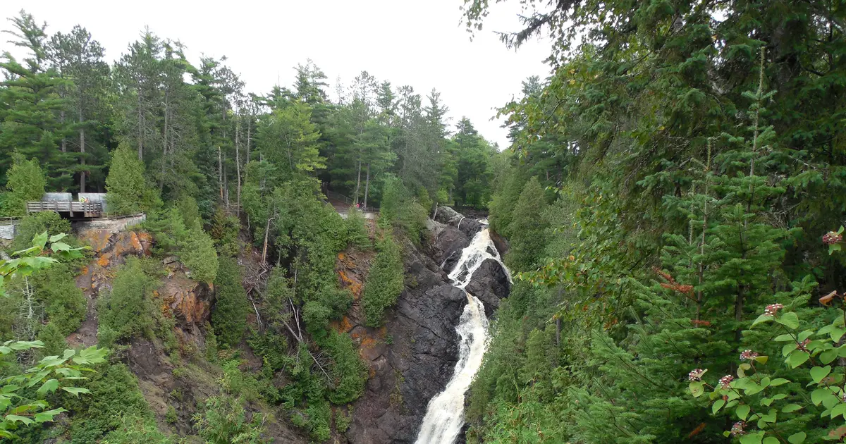

Wisconsin has 48 named waterfalls in the U.S. Geological Survey Geographic Names Information System, the features classified as Falls. That count ranks Wisconsin 16th among the 50 states. The figure comes from the GNIS domestic-names extract in this site, committed 2026-10-02, and this page was published 2026-11-19. The latest feature-edit date stored on these Falls records is December 30, 2020.
National rank and density
Divided by the state's land area of 54,168 square miles, from the U.S. Census Bureau 2024 Gazetteer (ALAND_SQMI, land only, inland water excluded), Wisconsin has 0.89 named falls per 1,000 square miles. That density ranks 19th of the 50 states. The national named total in this extract is 2,514 falls across the 50 states, so Wisconsin holds 1.9 percent of them.
Bordering states, with their named-falls counts: Illinois (6, no separate count page); Iowa (1, no separate count page); Michigan (199); Minnesota (41).
Where the named falls cluster
Wisconsin's named falls are filed under 16 county equivalents. The largest counts are Marinette (13), Menominee (9), and Douglas (4), 26 falls and 54.2 percent of the state total.
The Wisconsin waterfall map plots the same named falls. County names are the labels GNIS recorded. Connecticut's file uses planning regions, Alaska's uses boroughs and census areas, and Louisiana's uses parishes, so the column is not always a traditional county.
| County or equivalent | Named falls | Share | Examples |
|---|---|---|---|
| Marinette | 13 | 27.1% | Big Quinnesec Falls (historical), Bull Falls, Daves Falls |
| Menominee | 9 | 18.8% | Beartrap Falls, Big Eddy Falls, Big Smoky Falls |
| Douglas | 4 | 8.3% | Amnicon Falls, Big Manitou Falls, Little Manitou Falls |
| Ashland | 3 | 6.3% | Brownstone Falls, Copper Falls, Morgan Falls |
| Sawyer | 3 | 6.3% | Bellile Falls, Little Falls, Pipestone Falls |
| Shawano | 3 | 6.3% | Freeman Falls, Gilmer Falls, Little Bull Falls |
| Eau Claire | 2 | 4.2% | Big Falls, Hamilton Falls |
| Iron | 2 | 4.2% | Potato River Falls, Spring Camp Falls |
| Jackson | 2 | 4.2% | Ni-ho-kha-wa-ne-ey-ja, Polly Falls |
| Florence | 1 | 2.1% | Breakwater Falls |
| Lincoln | 1 | 2.1% | Grandfather Falls |
| Manitowoc | 1 | 2.1% | Cato Falls |
| Sauk | 1 | 2.1% | Skillet Falls |
| St. Croix | 1 | 2.1% | Apple River Falls |
| Waupaca | 1 | 2.1% | Little Falls |
| Wood | 1 | 2.1% | Little Bull Falls |
Why Wisconsin's count looks like this
Most of Wisconsin was planed by ice into country that does not make waterfalls. The names that exist are in the north, on the Canadian Shield. Marinette County leads, then Menominee, along the northeast edge where rivers still drop off hard volcanic rock toward Green Bay and the Menominee River. Douglas County adds a smaller Lake Superior shore group.
South of the Shield the glacial deposits bury the old ledges. A named fall in the south is an oddity, not a pattern. The state’s total looks modest next to Michigan’s Upper Peninsula because Wisconsin only owns a strip of that same rock, along its northern border, rather than a whole peninsula of it.
Named falls we publish
We publish a full page for 18 of the 48 named falls. A page exists when the fall has at least 25 Google reviews, a sourced trip guide, or at least 200 characters of USGS description or history. The other 30 stay on the state guide as names and coordinates. The Wisconsin state guide also lists 2 other places from Google Maps that are not in the GNIS Falls extract, so the guide's total is 50.
- Daves Falls (Marinette · 241 Google reviews)
- Potato River Falls (Iron · 162 Google reviews)
- Big Manitou Falls (Douglas · 156 Google reviews)
- Long Slide Falls (Marinette · 131 Google reviews)
- Horseshoe Falls (Marinette · 80 Google reviews)
- Morgan Falls (Ashland · 79 Google reviews)
- Little Manitou Falls (Douglas · 69 Google reviews · Little Manitou Falls Trail)
- Amnicon Falls (Douglas · 67 Google reviews)
- Copper Falls (Ashland · 63 Google reviews)
- Smalley Falls (Marinette · 62 Google reviews)
- Strong Falls (Marinette · 52 Google reviews)
- Big Smoky Falls (Menominee · 51 Google reviews)
Those are the 12 published pages with the most Google reviews. The state guide links the rest.
Tallest falls on the record
The national roundup, the largest waterfalls in the U.S. by state, does not name a single well-documented tallest waterfall for Wisconsin. None of the USGS descriptions in our file state a height in feet for a named fall here. We do not estimate one.
National parks
None of the national park guides on this site currently include a published waterfall inside Wisconsin. Named falls here are on other public or private land. The state guide is the place to check access. We do not assign falls to a national forest unless a park boundary in our file contains them.
Trails we can measure
These distances come from the trail notes already attached to the published pages, either a sourced trip guide or an OpenStreetMap path. A blank distance means the map did not give one we were willing to print.
- Little Manitou Falls: Little Manitou Falls Trail
When to go in Wisconsin
April and May are the peak, when the northern snowpack melts and the Shield rivers come up. Black flies arrive with the end of that melt. Summer is lower and warmer, and the sandstone and basalt ledges are still slippery. Winter ice on the Marinette County drops is a local season of its own, and the roads that reach them are not all plowed for sightseeing.
How this number was counted
Named falls are records with feature class Falls in the USGS National Map GNIS domestic names, filtered to this state in data/gnis-waterfalls.json. The download script is scripts/prepare-gnis.mjs, pointed at the USGS domestic-names file. Land area is ALAND_SQMI in the Census Bureau 2024 Gazetteer national state file, written by scripts/prepare-state-areas.mjs. Density is named falls divided by land area, times 1,000. The full 50-state ranking, including states with too few named falls for their own page, is Which state has the most waterfalls?.
Frequently asked questions
How many waterfalls are in Wisconsin?
Wisconsin has 48 named waterfalls in the USGS GNIS Falls class, ranking 16th of the 50 states. The extract used here was committed 2026-10-02, and this page was published 2026-11-19.
Which county in Wisconsin has the most named waterfalls?
Marinette has the most, with 13 named falls. Menominee is next with 9.
How many Wisconsin waterfalls have a page on this site?
18 of the 48 named falls have a published page. A page requires 25 or more Google reviews, a sourced trip guide, or at least 200 characters of USGS description or history.
When is the best time to see waterfalls in Wisconsin?
April and May are the peak, when the northern snowpack melts and the Shield rivers come up. Black flies arrive with the end of that melt. Summer is lower and warmer, and the sandstone and basalt ledges are still slippery. Winter ice on the Marinette County drops is a local season of its own, and the roads that reach them are not all plowed for sightseeing.
Where in Wisconsin are the named waterfalls?
In the north. Marinette County has the most, Menominee County is next, and a smaller group sits in Douglas County on Lake Superior. Southern Wisconsin was glaciated into low relief and has very few named falls.