
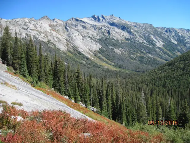
Montana does not get a single “peak week” from the sources used here, and this page does not borrow one from a foliage-predictor slider. What the state has published, in Montana Outdoors, is the larch. Western larch paints the lower elevations in mid-to-late October. Alpine larch, above about 5,000 feet, fades from green to gold in October. A photo caption on that PDF says “alpine larch in late September in the Purcell Mountains,” which is a picture, not the article’s peak sentence. The Forest Service says alpine larch needles turn brilliant yellow-orange each October above about 7,000 feet in western Montana.
Visit Montana’s Empire Builder note says cooler weather in late September and early October turns the leaves to gold along that route, from prairie to mountain. An October 1, 2025 release said peak was making its way across the state. That is a status line for that date, not a normal window. The Forest Service’s northern-region list adds aspen, cottonwood, birch, and western larch “golden in late fall,” without a finer calendar.
Peak timing varies from year to year. A warm fall, an early frost, or a windstorm can move or mute the color, which is why the live report matters more than any calendar.
When color usually arrives
Lower and middle elevations, western larch
Mid-to-late October, in the Montana Outdoors portrait. These are the larches people see from valley roads, not the alpine species.
Montana FWP, Montana Outdoors. Source: Montana Outdoors, alpine larch.
Alpine larch
Gold in October above about 5,000 feet, in the same FWP piece. The Forest Service puts the yellow-orange turn each October above about 7,000 feet in western Montana. The two elevation figures are both official and not identical. Quote the one that matches the article you are using.
FWP and the Forest Service, both October, different elevation cutoffs. Source: USDA Forest Service, fall color in conifers.
Fall foliage map
Esri publishes a public ArcGIS experience called Fall Foliage Viewing. It is embedded here as a map you can pan. It is not the source of the dates on this site. If the embed is blocked or slow, the state reports linked above and below still stand on their own. For Montana, it opens centered on the state. The center is the middle of the state's bounding box in the U.S. Census Bureau cartographic boundary, 2017 edition. The colored prediction layer in the experience is the Massachusetts Department of Conservation and Recreation forecast published in that app. It is not a forecast for any other state.
Map of waterfalls in Montana
Larger gold markers are the waterfalls on this page's itinerary. Smaller markers are the other published waterfall pages in Montana. The outline is the U.S. Census Bureau cartographic boundary for the state (2017, public domain). A marker is the mapped position of the falls, not a trailhead.
Published waterfall page On this foliage trip
On this trip
- Kootenai Falls, Lincoln County
- Skalkaho Falls, Ravalli County
- Virginia Falls, Glacier County
Other published waterfall pages in Montana
- Apikuni Falls, Glacier County
- Baring Falls, Glacier County
- Big Falls, Cascade County
- Bird Woman Falls, Flathead County
- Grotto Falls, Gallatin County
- Martin Falls, Flathead County
- McDonald Falls, Flathead County
- Memorial Falls, Cascade County
- Morrell Falls, Powell County
- Ousel Falls, Gallatin County
- Palisade Falls, Gallatin County
- Palisades Falls, Gallatin County
- Redrock Falls, Glacier County
- Running Eagle Falls, Glacier County
- Woodbine Falls, Stillwater County
- Yaak Falls, Lincoln County
Open the interactive Montana waterfall map. That map also includes named falls that do not have their own page.
The live report
Tourism points at a predictor tool. The articles opened for this guide did not print regional dates out of that tool, so the dates here stay with FWP and the Forest Service. Visit Montana foliage predictor.
Waterfalls to see with the color
Kootenai Falls is Lincoln County, in the northwest, which is western-larch country and the mid-to-late October lower-elevation window. Skalkaho Falls is Ravalli County, in the Bitterroot, the same western-Montana larch landscape the Forest Service describes. Virginia Falls is Glacier County. The coordinate is about 48.66 N, 113.61 W, in the Many Glacier side of the park. Alpine larch, not the valley larch, is the high-country October note if you leave the waterfall and climb. The waterfall page itself is not an alpine-larch grove.
Kootenai Falls
Lincoln County · nearest listed town Libby
- Reviews
- 137 · 4.8 stars
Skalkaho Falls
Ravalli County · nearest listed town Hamilton
- Reviews
- 108 · 4.8 stars
Virginia Falls
Glacier County · nearest listed town North Browning
- Trail
- Virginia Falls Viewpoint Trail
- Reviews
- 95 · 4.9 stars
Trail name, distance, elevation, and difficulty come from data/trails.json or a hand-checked trip note when one exists. A missing row means that field was not in those files. Drop is shown only when the USGS gazetteer text states a height.
Northwest and the Bitterroot for valley larch, Glacier if you want the park
Libby and Hamilton are western-Montana valley pages. Mid-to-late October is the FWP line for western larch at those elevations. Browning is across the divide, and the straight-line miles will say so. Late September and early October is the Empire Builder sentence for gold along that rail route, which is a different corridor from Kootenai Falls. Use the sentence that matches the road you are on.
| From | To | Straight-line miles |
|---|---|---|
| Kootenai Falls | Skalkaho Falls | 176.9 |
| Skalkaho Falls | Virginia Falls | 166.3 |
National parks on our guides
Glacier National Park is the guide that overlaps Virginia Falls’ coordinate if that fall is inside the park boundary used on the park pages. The foliage fact that belongs on this page is the larch calendar, not a claim that the waterfall peaks in a certain week. Alpine larch is an October gold above the elevations FWP and the Forest Service name.
- Glacier National Park — 7 published waterfalls filed in Montana
Trees and the colors they are credited with
- Western larch and alpine larch. FWP separates the two: western larch on the lower slopes in mid-to-late October, alpine larch higher in October. The Forest Service northern-region list also names quaking aspen, cottonwood, and birch, with western larch golden in late fall. (USDA Forest Service, Fall Colors)
Frequently Asked Questions
When does western larch turn?
Montana FWP says mid-to-late October at lower elevations. Alpine larch goes gold in October higher up, above about 5,000 feet in that article and above about 7,000 feet in the Forest Service conifer note.
Is there one statewide peak week?
Not in the sources used here. Visit Montana has a predictor, and the press notes opened for this guide did not print its regional dates. The October 1, 2025 line only says peak was moving across the state that day.
Which falls are in larch country?
Kootenai Falls in Lincoln County and Skalkaho Falls in Ravalli County. Virginia Falls is the Glacier County page.
Photographs
Sources
- Montana Outdoors, alpine larch
- USDA Forest Service, fall color in conifers
- Visit Montana foliage predictor
- USDA Forest Service, Fall Colors
- File:30 nonplot bitterroot mountains 09142016175409 (40476742625).jpg
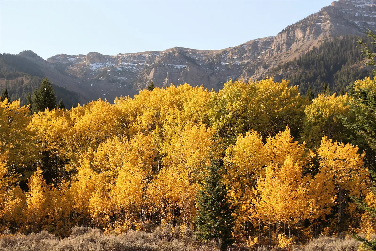
- File:A closeup of golden autumn aspens at Red Rock Lakes National Wildlife Refuge (51788094131).jpg