
The park describes itself as 75 miles from Washington, DC, with cascading waterfalls across more than 200,000 acres. Eight of our published pages sit inside the boundary. Seven of them have a sourced distance and an elevation figure. That is a better planning set than the western parks, where the famous names often have reviews and no mileage.
Dark Hollow has 159 of the 373 reviews. Miller Falls has a USGS height of 25 feet and no hike length, so it cannot be ranked against the others. It stays on the list because the coordinate is inside the park and the gazetteer says so.
The falls on our maps
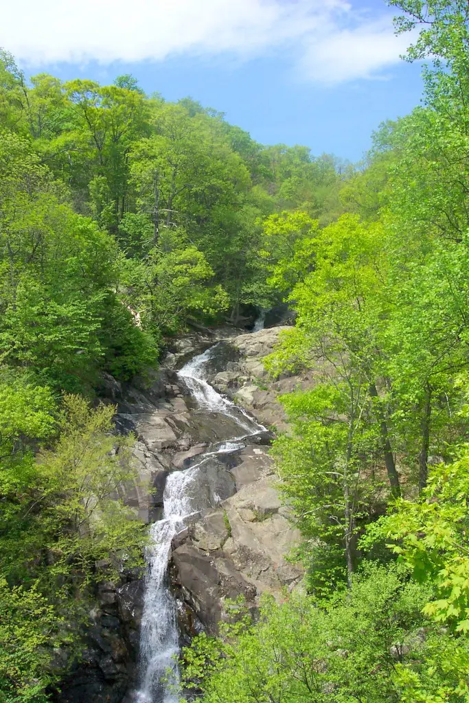
Whiteoak is the pair to read twice. Lower and upper are separate pages and separate distances, and both carry the Whiteoak Canyon Trail name.
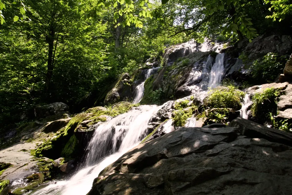
Dark Hollow Falls
Madison County, Virginia · nearest listed town Stanley (5.8 miles in a straight line)
- Trail
- Dark Hollow Falls Trail
- Distance
- 1.4 miles round trip (round trip)
- Elevation
- 440 feet
- Difficulty
- Moderate (NPS): short but very steep and rocky; the climb back up is the hard part
- Reviews
- 159 · 4.7 stars
Miller Falls
Warren County, Virginia · nearest listed town Washington (5.4 miles in a straight line)
- Drop
- 25 ft in the USGS gazetteer text
Approx. 25 feet tall; in Shenandoah National Park, on the NW slope of Mount Marshall, 2.4 mi. SSE of Browntown, 0.9 mi. WSW of Hogwallow Flat.
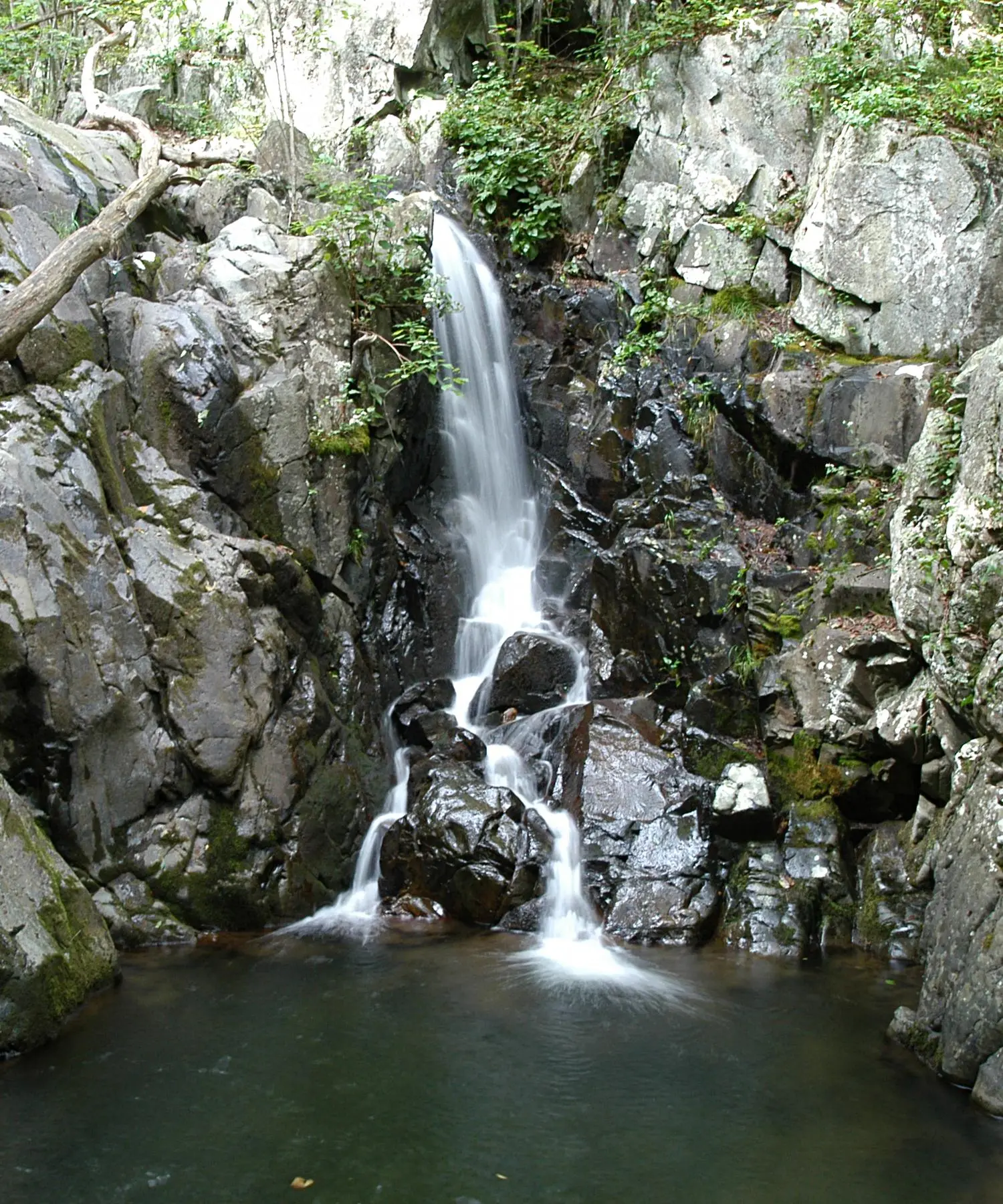
Rose River Falls
Madison County, Virginia · nearest listed town Stanley (5.9 miles in a straight line)
- Trail
- Skyland-Big Meadows Horse Trail
- Distance
- 4 miles loop (loop)
- Elevation
- 910 feet
- Difficulty
- Moderate (NPS); steep, rocky section past cascades on the return
- Reviews
- 33 · 4.9 stars
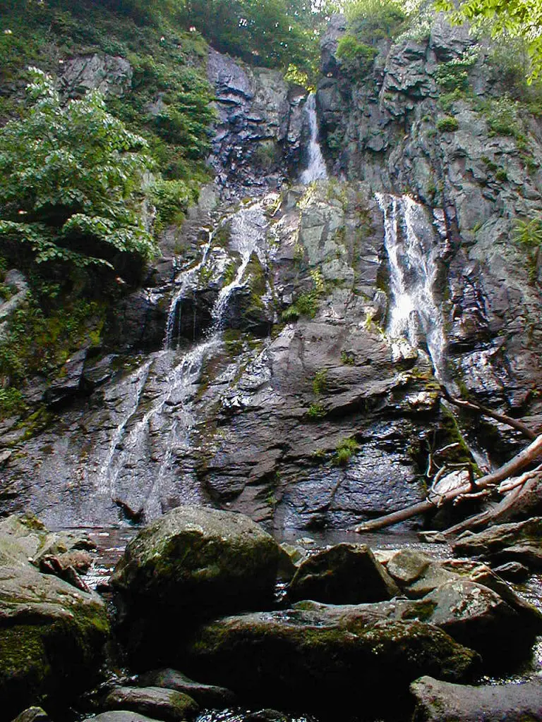
South River Falls
Greene County, Virginia · nearest listed town Stanardsville (6.6 miles in a straight line)
- Distance
- 3.3 miles loop (loop)
- Elevation
- 910 feet
- Difficulty
- Moderate (NPS)
- Reviews
- 47 · 4.7 stars
Overall Run Falls
Rappahannock County, Virginia · nearest listed town Washington (8.7 miles in a straight line)
- Trail
- Traces Trail
- Distance
- 5.1 miles round trip (round trip)
- Elevation
- 1,291 feet
- Difficulty
- Moderately strenuous (NPS)
- Reviews
- 46 · 4.6 stars
- Flow timing
- After plentiful rain; NPS notes the falls may have minimal to no flow otherwise
Lower Whiteoak Falls
Page County, Virginia · nearest listed town Stanley (8.2 miles in a straight line)
- Trail
- Whiteoak Canyon Trail
- Distance
- 2 miles round trip (round trip)
- Elevation
- 500 feet
- Difficulty
- Easiest (NPS rating)
- Reviews
- 38 · 4.9 stars
Doyles River Falls
Rockingham County, Virginia · nearest listed town Grottoes (7.6 miles in a straight line)
- Trail
- Doyles River Trail
- Distance
- 3.3 miles round trip (round trip)
- Elevation
- 1,189 feet
- Difficulty
- Moderate (NPS)
- Reviews
- 25 · 4.3 stars
Upper Whiteoak Falls
Page County, Virginia · nearest listed town Stanley (7.5 miles in a straight line)
- Trail
- Whiteoak Canyon Trail
- Distance
- 4.6 miles round trip (round trip)
- Elevation
- 1,040 feet
- Difficulty
- Moderate (NPS)
- Reviews
- 25 · 4.9 stars
Side by side
Elevation here is unusually complete. The dashes are Miller Falls, which has a height and no trail row.
| Waterfall | Distance | Elevation | Difficulty | USGS drop | Reviews | Flow note |
|---|---|---|---|---|---|---|
| Dark Hollow Falls | 1.4 miles round trip | 440 feet | Moderate (NPS): short but very steep and rocky; the climb back up is the hard part | — | 159 | — |
| Miller Falls | — | — | — | 25 ft | — | — |
| Rose River Falls | 4 miles loop | 910 feet | Moderate (NPS); steep, rocky section past cascades on the return | — | 33 | — |
| South River Falls | 3.3 miles loop | 910 feet | Moderate (NPS) | — | 47 | — |
| Overall Run Falls | 5.1 miles round trip | 1,291 feet | Moderately strenuous (NPS) | — | 46 | After plentiful rain; NPS notes the falls may have minimal to no flow otherwise |
| Lower Whiteoak Falls | 2 miles round trip | 500 feet | Easiest (NPS rating) | — | 38 | — |
| Doyles River Falls | 3.3 miles round trip | 1,189 feet | Moderate (NPS) | — | 25 | — |
| Upper Whiteoak Falls | 4.6 miles round trip | 1,040 feet | Moderate (NPS) | — | 25 | — |
A dash means that field is not in the USGS gazetteer text, the trail file, or the hand-checked trip notes for that fall. It is not a claim that the number is zero.
Effort against attention
Dark Hollow Falls is the short, steep one: 1.4 miles round trip, 440 feet, rated moderate by NPS with the note that the climb back up is the hard part. It also has the reviews. Overall Run Falls is the long one, 5.1 miles round trip and 1,291 feet, and the NPS thing-to-do page says the fall may have minimal or no flow except after plentiful rain. A high reviews-per-mile score would be the wrong reason to pick Overall Run in a dry week.
Lower Whiteoak Falls is 2 miles round trip and 500 feet, called easiest by NPS. Upper Whiteoak Falls is 4.6 miles round trip and 1,040 feet on the same trail name. The mileage total below counts 4.6 miles once, not 6.6 miles. Adding both would walk the lower canyon twice. Rose River is a 4-mile loop with 910 feet, and South River is a 3.3-mile loop with 910 feet. Those are separate trails, so both stay in the sum.
- Dark Hollow Falls: 159 reviews ÷ 1.4 miles = 114 reviews per published mile (round trip).
- Lower Whiteoak Falls: 38 reviews ÷ 2.0 miles = 19 reviews per published mile (round trip).
- South River Falls: 47 reviews ÷ 3.3 miles = 14 reviews per published mile (loop).
- Overall Run Falls: 46 reviews ÷ 5.1 miles = 9 reviews per published mile (round trip).
- Rose River Falls: 33 reviews ÷ 4.0 miles = 8 reviews per published mile (loop).
- Doyles River Falls: 25 reviews ÷ 3.3 miles = 8 reviews per published mile (round trip).
- Upper Whiteoak Falls: 25 reviews ÷ 4.6 miles = 5 reviews per published mile (round trip).
Seeing more than one
A single short day with sourced numbers is Dark Hollow, 1.4 miles round trip. The return is the steep part, not the walk down. A longer single day that still uses one trail name is Upper Whiteoak at 4.6 miles round trip, which is the figure that covers the canyon we list twice.
Two days, without claiming the trailheads share a parking lot: day one Dark Hollow, day two either the Whiteoak Canyon Trail at the longer distance or Overall Run if you have checked that the creek is actually running. Doyles River is its own 3.3 miles round trip and 1,189 feet. The straight-line chain from the northernmost coordinate is Overall Run Falls, Miller Falls, Upper Whiteoak Falls, Lower Whiteoak Falls, Rose River Falls, Dark Hollow Falls, South River Falls, Doyles River Falls. Summed hike lengths, with Whiteoak counted once, come to 21.7 miles. Elevation we can add, skipping any figure that says "more than" or "descent," is 6,280 feet across 7 hikes.
When the nearest gauge runs high
S F SHENANDOAH RIVER NEAR LYNNWOOD, VA (USGS 01628500) is 6.8 miles from Doyles River Falls. From 2019 through 2024 its mean daily discharge peaked in February at 1,694 cubic feet per second and was lowest in July at 420. Shenandoah's falls are short side streams off a ridge. One downstream gauge is a regional rain signal, not a reading for Overall Run, which NPS already says can be dry without recent rain.
| Jan | Feb | Mar | Apr | May | Jun | Jul | Aug | Sep | Oct | Nov | Dec |
|---|---|---|---|---|---|---|---|---|---|---|---|
| 1,389 | 1,694 | 1,369 | 1,426 | 1,164 | 732 | 420 | 666 | 883 | 744 | 722 | 880 |
Fees, passes, and entry rules
The entrance pass is ordinary. The planning wrinkle is cashless payment and which trailhead sells the pass.
- Private vehicle
- $30 for seven consecutive days.
- On foot or bicycle
- $15 for visitors 16 and older. Children under 16 are free on this rate.
- Motorcycle
- $25 for seven days, up to two motorcycles and four people.
- How to pay
- Trip notes checked against the fee page: the park is cashless at these entrances, and annual and interagency passes are accepted.
Getting there
The trip notes for Lower Whiteoak say passes are sold at the Whiteoak Canyon lower trailhead. The fee page sets the price at $30 per vehicle for seven days and $15 for someone walking or biking. Annual and interagency passes are accepted.
What this park warns about
NPS rates Dark Hollow moderate and specifically says the climb back is the hard part of a short, rocky trail. Doyles River, Rose River, South River, and Upper Whiteoak are all marked moderate in the trip notes, with elevation gains from 910 to 1,189 feet. Lower Whiteoak is the one marked easiest. Those words are the difficulty column. They are not interchangeable.
Small things the official pages mention
- Overall Run may have minimal or no flow except after plentiful rain. (NPS Overall Run)
- Lower Whiteoak is the easiest rating in this set, 2 miles round trip and 500 feet. (NPS Lower Whiteoak)
Towns our directory files these falls under
The town names are Stanley, Washington, Stanardsville, and Grottoes. They are the nearest cities in our index, spread along the ridge, not one base town.
- Washington, VA — 4 of these falls, closest about 5 miles in a straight line
- Stanley, VA — 4 of these falls, closest about 6 miles in a straight line
Photographs
How this page was built
Reviews per mile uses published round trips and loops as written. Upper and lower Whiteoak share a trail name, so the see-all mileage keeps the longer one only. Miller Falls is omitted from both sums because it has no distance. The gauge, if shown, is the nearest discharge station with a 2019–2024 daily record, not a gauge on each hollow.
Sources
- NPS administrative boundaries
- Shenandoah National Park
- NPS: Shenandoah fees
- NPS: Overall Run Falls
- NPS: Dark Hollow Falls
- OpenStreetMap contributors (way 20332355)
- NPS: Rose River Falls
- NPS: South River Falls
- NPS: Whiteoak Falls (Lower)
- OpenStreetMap contributors (way 550940431)
- NPS: Doyles River Falls
- OpenStreetMap contributors (way 319751620)
- NPS: Whiteoak Falls (Upper)
- USGS 01628500 S F SHENANDOAH RIVER NEAR LYNNWOOD, VA
- File:Dark Hollow Falls Shenandoah NP 2007.jpg
- File:Whiteoak Canyon Shenandoah NP 2005.jpg
- File:South River Falls Shenandoah NP 2007.jpg
- File:Rose river falls Shenandoha Virginia USA.jpg