
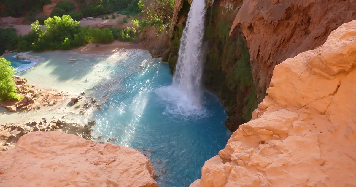

Arizona has 26 named waterfalls in the U.S. Geological Survey Geographic Names Information System, the features classified as Falls. That count ranks Arizona tied for 24th with Massachusetts and Oklahoma among the 50 states. The figure comes from the GNIS domestic-names extract in this site, committed 2026-10-02, and this page was published 2026-11-19. The latest feature-edit date stored on these Falls records is December 30, 2020.
National rank and density
Divided by the state's land area of 113,655 square miles, from the U.S. Census Bureau 2024 Gazetteer (ALAND_SQMI, land only, inland water excluded), Arizona has 0.23 named falls per 1,000 square miles. That density ranks 35th of the 50 states. The national named total in this extract is 2,514 falls across the 50 states, so Arizona holds 1 percent of them.
Bordering states, with their named-falls counts: California (181); Colorado (80); Nevada (8, no separate count page); New Mexico (14); Utah (22).
Where the named falls cluster
Arizona's named falls are filed under 10 county equivalents. The largest counts are Coconino (11), Mohave (3), and Pima (3), 17 falls and 65.4 percent of the state total.
The Arizona waterfall map plots the same named falls. County names are the labels GNIS recorded. Connecticut's file uses planning regions, Alaska's uses boroughs and census areas, and Louisiana's uses parishes, so the column is not always a traditional county.
| County or equivalent | Named falls | Share | Examples |
|---|---|---|---|
| Coconino | 11 | 42.3% | Beaver Falls, Black Falls, Cheyava Falls |
| Mohave | 3 | 11.5% | Columbine Falls, Travertine Falls, Whitmore Rapids |
| Pima | 3 | 11.5% | Chiva Falls, Seven Cataracts, Tanque Verde Falls |
| Greenlee | 2 | 7.7% | Chitty Falls, Sardine Falls |
| Yavapai | 2 | 7.7% | Minnehaha Waters, The Falls |
| Apache | 1 | 3.8% | Big Flow |
| Cochise | 1 | 3.8% | Winn Falls |
| Gila | 1 | 3.8% | Workman Creek Falls |
| Graham | 1 | 3.8% | Ash Creek Falls |
| Yuma | 1 | 3.8% | Glynns Falls |
Every named fall in the extract:
| Name | County or equivalent | On this site |
|---|---|---|
| Ash Creek Falls | Graham | Listed on the state guide |
| Beaver Falls | Coconino | Published page |
| Big Flow | Apache | Listed on the state guide |
| Black Falls | Coconino | Listed on the state guide |
| Cheyava Falls | Coconino | Listed on the state guide |
| Chitty Falls | Greenlee | Listed on the state guide |
| Chiva Falls | Pima | Published page |
| Columbine Falls | Mohave | Listed on the state guide |
| Deer Creek Falls | Coconino | Listed on the state guide |
| Fiftyfoot Falls | Coconino | Listed on the state guide |
| Glynns Falls | Yuma | Listed on the state guide |
| Grand Falls | Coconino | Published page |
| Havasu Falls | Coconino | Published page |
| Minnehaha Waters | Yavapai | Listed on the state guide |
| Mooney Falls | Coconino | Published page |
| Navajo Falls | Coconino | Published page |
| Ribbon Falls | Coconino | Published page |
| Sardine Falls | Greenlee | Listed on the state guide |
| Seven Cataracts | Pima | Listed on the state guide |
| Tanque Verde Falls | Pima | Published page |
| The Falls | Yavapai | Listed on the state guide |
| Travertine Falls | Mohave | Listed on the state guide |
| Two Hundred and Fivemile Rapids | Coconino | Listed on the state guide |
| Whitmore Rapids | Mohave | Listed on the state guide |
| Winn Falls | Cochise | Listed on the state guide |
| Workman Creek Falls | Gila | Listed on the state guide |
Why Arizona's count looks like this
Arizona’s named falls are a high-country and canyon count in a dry state. Coconino County leads by a clear margin. That is the Mogollon Rim, the San Francisco volcanic field, and the Grand Canyon’s rims: places where elevation still wrings a storm or a snowpack out of the air, and where a creek can fall off a limestone or basalt lip. The rest of the counties are ones and twos.
A desert fall is often a pour-off that runs for hours after a monsoon cell and is a dry stain the next day. GNIS records the name anyway. Grand Canyon National Park and Saguaro National Park each have a published page where a named fall sits inside the boundary. Neither park is the reason Coconino County leads. The rim and the high plateaus are.
Named falls we publish
We publish a full page for 8 of the 26 named falls. A page exists when the fall has at least 25 Google reviews, a sourced trip guide, or at least 200 characters of USGS description or history. The other 18 stay on the state guide as names and coordinates. The Arizona state guide also lists 4 other places from Google Maps that are not in the GNIS Falls extract, so the guide's total is 30.
- Havasu Falls (Coconino · 679 Google reviews · 10 miles one way)
- Grand Falls (Coconino · 377 Google reviews)
- Tanque Verde Falls (Pima · 169 Google reviews)
- Beaver Falls (Coconino · 123 Google reviews · Beaver Falls Trail)
- Chiva Falls (Pima · 31 Google reviews)
- Ribbon Falls (Coconino · 26 Google reviews · Ribbon Falls Trail)
- Navajo Falls (Coconino · 25 Google reviews)
- Mooney Falls (Coconino)
Tallest falls on the record
The national roundup, the largest waterfalls in the U.S. by state, does not name a single well-documented tallest waterfall for Arizona. Separately, the tallest height written into the USGS gazetteer text in our file is Havasu Falls at 170 feet. Most Falls records state no height, so this is not a ranking of the tallest waterfall in the state.
National parks
These national park guides include a published waterfall whose coordinates fall inside the park and inside Arizona.
- Grand Canyon National Park (1 published waterfall in Arizona: Ribbon Falls)
- Saguaro National Park (1 published waterfall in Arizona: Bridal Wreath Falls)
Trails we can measure
These distances come from the trail notes already attached to the published pages, either a sourced trip guide or an OpenStreetMap path. A blank distance means the map did not give one we were willing to print.
- Havasu Falls: 10 miles one way
- Beaver Falls: Beaver Falls Trail
- Ribbon Falls: Ribbon Falls Trail
When to go in Arizona
There are two water seasons, and they do not match. Winter storms and snowmelt, late winter into spring, feed the high rims and the sky-island creeks. The summer monsoon, July into early September, is what makes the ephemeral canyon pour-offs run, sometimes dangerously and briefly. A spring trip and a monsoon trip are not interchangeable, and a June trip is often the gap between them.
How this number was counted
Named falls are records with feature class Falls in the USGS National Map GNIS domestic names, filtered to this state in data/gnis-waterfalls.json. The download script is scripts/prepare-gnis.mjs, pointed at the USGS domestic-names file. Land area is ALAND_SQMI in the Census Bureau 2024 Gazetteer national state file, written by scripts/prepare-state-areas.mjs. Density is named falls divided by land area, times 1,000. The full 50-state ranking, including states with too few named falls for their own page, is Which state has the most waterfalls?.
Frequently asked questions
How many waterfalls are in Arizona?
Arizona has 26 named waterfalls in the USGS GNIS Falls class, ranking tied for 24th with Massachusetts and Oklahoma of the 50 states. The extract used here was committed 2026-10-02, and this page was published 2026-11-19.
Which county in Arizona has the most named waterfalls?
Coconino has the most, with 11 named falls. Mohave is next with 3.
How many Arizona waterfalls have a page on this site?
8 of the 26 named falls have a published page. A page requires 25 or more Google reviews, a sourced trip guide, or at least 200 characters of USGS description or history.
When is the best time to see waterfalls in Arizona?
There are two water seasons, and they do not match. Winter storms and snowmelt, late winter into spring, feed the high rims and the sky-island creeks. The summer monsoon, July into early September, is what makes the ephemeral canyon pour-offs run, sometimes dangerously and briefly. A spring trip and a monsoon trip are not interchangeable, and a June trip is often the gap between them.
Which Arizona county has the most named waterfalls?
Coconino County. It covers the Mogollon Rim, the San Francisco Peaks country and part of the Grand Canyon region. The other counties have only a few named falls each.