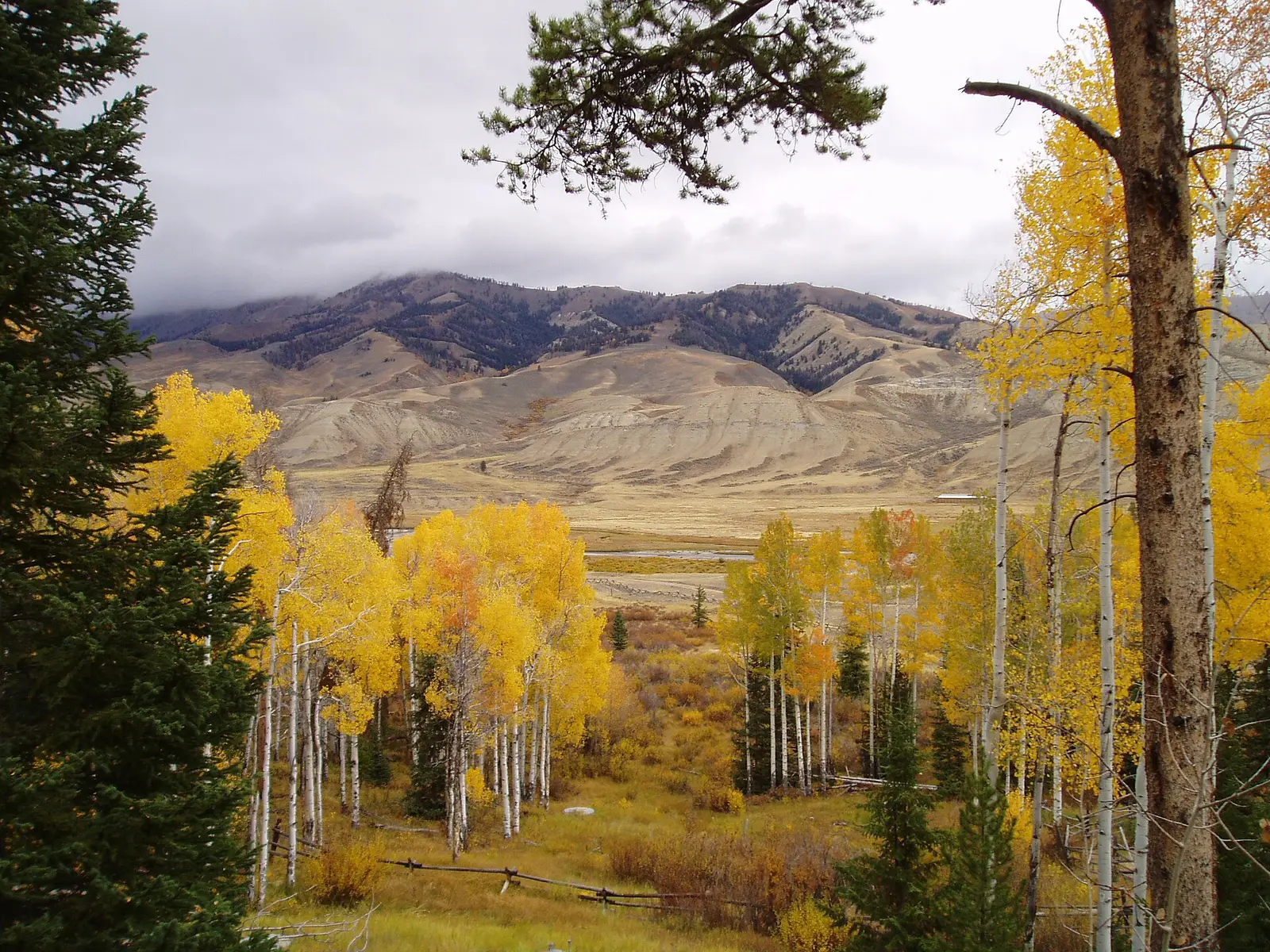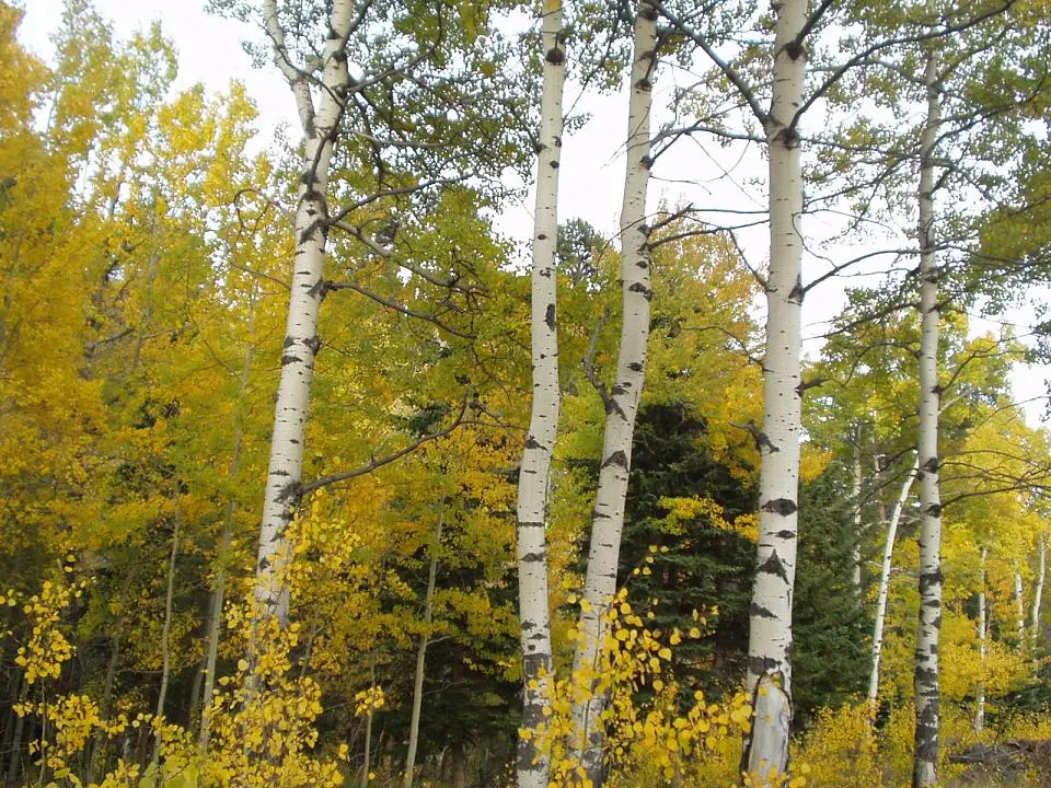
Travel Wyoming’s foliage story says the viewing window runs from September into mid-October, and it repeats a six-week period from early September to mid-October for the brightest reds and golds. Higher mountains come before valleys in the way that story is framed, without a numbered week for the Wind Rivers versus the plains. Aspen Alley is the exception with its own line: the foliage there generally peaks in late September.
The Forest Service names the Snowy Range Scenic Byway for aspen, willow, and cottonwood on the Medicine Bow, and it does not date Wyoming separately from the Colorado side of that forest. This page uses the Travel Wyoming window for the state and does not import the White River’s late-September sentence across the border.
Peak timing varies from year to year. A warm fall, an early frost, or a windstorm can move or mute the color, which is why the live report matters more than any calendar.
When color usually arrives
The six-week state window
Early September to mid-October, described as the period for the brightest reds and golds. The story says the season runs from September into mid-October and that higher country precedes the valleys. It does not assign Jackson a week and Cheyenne another.
Travel Wyoming foliage story, page updated September 8, 2026. Source: Travel Wyoming, best places for fall foliage.
Aspen Alley
Generally peaks in late September. The story identifies the trees as mature quaking aspens. That is one grove, not the Teton range.
Typical, Travel Wyoming. Source: Travel Wyoming, best places for fall foliage.
Fall foliage map
Esri publishes a public ArcGIS experience called Fall Foliage Viewing. It is embedded here as a map you can pan. It is not the source of the dates on this site. If the embed is blocked or slow, the state reports linked above and below still stand on their own. For Wyoming, it opens centered on the state. The center is the middle of the state's bounding box in the U.S. Census Bureau cartographic boundary, 2017 edition. The colored prediction layer in the experience is the Massachusetts Department of Conservation and Recreation forecast published in that app. It is not a forecast for any other state.
Map of waterfalls in Wyoming
Larger gold markers are the waterfalls on this page's itinerary. Smaller markers are the other published waterfall pages in Wyoming. The outline is the U.S. Census Bureau cartographic boundary for the state (2017, public domain). A marker is the mapped position of the falls, not a trailhead.
Published waterfall page On this foliage trip
On this trip
- Hidden Falls, Teton County
- Mystic Falls, Teton County
- Shell Falls, Big Horn County
- Upper Falls of the Yellowstone River, Park County
Other published waterfall pages in Wyoming
- Albright Falls, Teton County
- Firehole Falls, Teton County
- Garden Creek Waterfall, Natrona County
- Lewis Falls, Lincoln County
- Lower Falls of the Yellowstone River, Park County
- Moose Falls, Teton County
- Popo Agie Falls, Fremont County
- Porcupine Falls, Big Horn County
- Undine Falls, Park County
- Wraith Falls, Park County
Open the interactive Wyoming waterfall map. That map also includes named falls that do not have their own page.
The live report
No weekly report was found. The story is the timing source. Travel Wyoming fall foliage story.
Waterfalls to see with the color
Mystic Falls and Hidden Falls are both filed under Moose Wilson Road, in Teton County, on the park side of Jackson Hole. Upper Falls of the Yellowstone is the Park County page. Shell Falls is Big Horn County. All four sit inside the early-September to mid-October window because that is the only state window Travel Wyoming printed. Aspen Alley’s late September is a grove near the Snowy Range, not these trailheads. Yellowstone and Grand Teton have their own waterfall guides. The foliage week is still the state window, not a date taken from a thermal-feature page.
Mystic Falls
Teton County · nearest listed town Moose Wilson Road
- Trail
- Mystic Falls Trail
- Distance
- 2.4 miles round trip
- Elevation
- Modest to the falls; about 500 feet more if you climb to the overlook
- Difficulty
- Rated moderately strenuous by the park
- Reviews
- 706 · 4.6 stars
Hidden Falls
Teton County · nearest listed town Moose Wilson Road
- Reviews
- 131 · 4.7 stars
Upper Falls of the Yellowstone River
Park County · nearest listed town Cody
- Reviews
- 229 · 4.8 stars
Shell Falls
Big Horn County · nearest listed town Greybull
- Reviews
- 83 · 4.8 stars
Trail name, distance, elevation, and difficulty come from data/trails.json or a hand-checked trip note when one exists. A missing row means that field was not in those files. Drop is shown only when the USGS gazetteer text states a height.
Jackson Hole and the Bighorns inside one six-week window
The two Teton pages can share a day if the trails are open. Cody and Greybull cannot share that day with them. The straight-line table is the proof. Early September is the start of the brightest period. Mid-October is the end. If you want the one grove with its own peak sentence, that is Aspen Alley in late September, and it is not a waterfall stop on this list.
| From | To | Straight-line miles |
|---|---|---|
| Mystic Falls | Hidden Falls | 49.9 |
| Hidden Falls | Upper Falls of the Yellowstone River | 66.6 |
| Upper Falls of the Yellowstone River | Shell Falls | 142.2 |
National parks on our guides
Yellowstone and Grand Teton are both on this site. Mystic Falls is on the Grand Teton guide. Upper Falls of the Yellowstone is the canyon page people mean when they say the park. The foliage window for planning is Travel Wyoming’s early September to mid-October, including Aspen Alley’s late September if that grove is the stop. Park thermal rules are a different subject and stay on the park guides.
- Yellowstone National Park — 8 published waterfalls filed in Wyoming
- Grand Teton National Park — 1 published waterfall filed in Wyoming
Trees and the colors they are credited with
- Aspen and cottonwood. Travel Wyoming says golden aspens, cottonwoods, and other vegetation. Aspen Alley is called out as mature quaking aspen. The Forest Service adds willow and cottonwood on the Snowy Range. (Travel Wyoming, best places for fall foliage)
Frequently Asked Questions
How long is Wyoming’s bright period?
Travel Wyoming says six weeks, from early September to mid-October, for the brightest reds and golds.
When is Aspen Alley?
Generally late September, in that same story. The trees are mature quaking aspens.
Which falls are in Teton County?
Mystic Falls and Hidden Falls, both filed at Moose Wilson Road. Upper Falls of the Yellowstone is Park County. Shell Falls is Big Horn County.
Photographs