
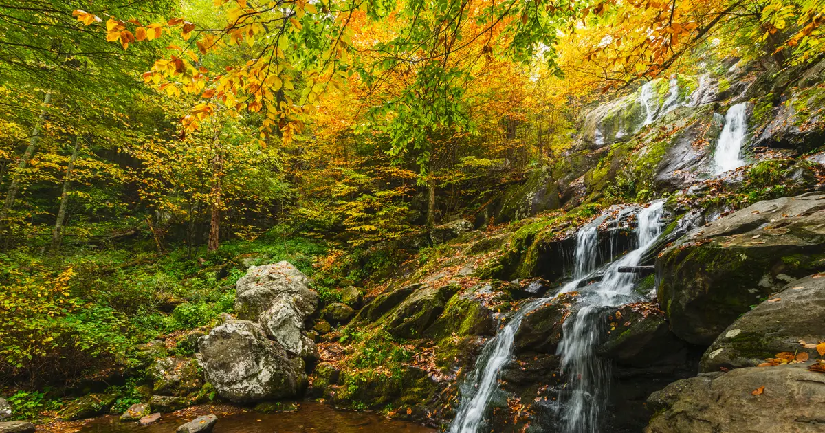

Virginia has 41 named waterfalls in the U.S. Geological Survey Geographic Names Information System, the features classified as Falls. That count ranks Virginia tied for 18th with Minnesota among the 50 states. The figure comes from the GNIS domestic-names extract in this site, committed 2026-10-02, and this page was published 2026-11-19. The latest feature-edit date stored on these Falls records is December 30, 2020.
National rank and density
Divided by the state's land area of 39,481 square miles, from the U.S. Census Bureau 2024 Gazetteer (ALAND_SQMI, land only, inland water excluded), Virginia has 1.04 named falls per 1,000 square miles. That density ranks 17th of the 50 states. The national named total in this extract is 2,514 falls across the 50 states, so Virginia holds 1.6 percent of them.
Bordering states, with their named-falls counts: Kentucky (17); Maryland (11); North Carolina (105); Tennessee (81); West Virginia (16).
Where the named falls cluster
Virginia's named falls are filed under 25 county equivalents. The largest counts are Giles (4), Madison (4), and Patrick (3), 11 falls and 26.8 percent of the state total.
The Virginia waterfall map plots the same named falls. County names are the labels GNIS recorded. Connecticut's file uses planning regions, Alaska's uses boroughs and census areas, and Louisiana's uses parishes, so the column is not always a traditional county.
| County or equivalent | Named falls | Share | Examples |
|---|---|---|---|
| Giles | 4 | 9.8% | Cascades, Falls of Dismal, Upper Falls |
| Madison | 4 | 9.8% | Big Rock Falls, Climbing Rose Falls, Dark Hollow Falls |
| Patrick | 3 | 7.3% | Great Falls of Dan, Smith River Falls, White Falls |
| Alleghany | 2 | 4.9% | Beaverdam Falls, Falling Spring Falls |
| Amherst | 2 | 4.9% | Panther Falls, Statons Creek Falls |
| Nelson | 2 | 4.9% | Crabtree Falls, The Falls |
| Page | 2 | 4.9% | Goods Falls, Lewis Spring Falls |
| Rockbridge | 2 | 4.9% | Gibbs Falls, Glenn Falls |
| Rockingham | 2 | 4.9% | Cedar Falls, Dry Run Falls |
| Russell | 2 | 4.9% | Big Falls, Tank Hollow Falls |
| Warren | 2 | 4.9% | Greasy Falls, Miller Falls |
| Albemarle | 1 | 2.4% | Jones Run Falls |
| Bath | 1 | 2.4% | Blue Suck Falls |
| Botetourt | 1 | 2.4% | Apple Orchard Falls |
| Craig | 1 | 2.4% | Meadow Creek Falls |
| Floyd | 1 | 2.4% | Styles Falls |
| Franklin | 1 | 2.4% | Falling Rock Falls |
| Frederick | 1 | 2.4% | Mountain Falls |
| Grayson | 1 | 2.4% | The Falls |
| Greene | 1 | 2.4% | South River Falls |
| Halifax | 1 | 2.4% | Hyco Falls (historical) |
| Mecklenburg | 1 | 2.4% | Eagle Point Falls (historical) |
| Montgomery | 1 | 2.4% | Big Falls |
| Scott | 1 | 2.4% | Monkey Falls |
| Washington | 1 | 2.4% | Abrams Falls |
Why Virginia's count looks like this
Virginia’s named falls are strung along the mountains rather than piled into one county. Madison and Giles counties tie for the largest share, and both shares are small. That fits the map: the Blue Ridge, the Valley and Ridge, and the Allegheny front each contribute a few names, and none of them produces a Transylvania-sized cluster. Shenandoah National Park holds several of the published pages, in Madison and neighboring counties, where basalt and greenstone make short, steep hollows.
The Piedmont and the coastal plain drop out of the list. The fall line at Richmond is a rapid and a historic drop on the James, and it is not a crowd of named mountain falls. Virginia’s total sits in the middle of the national list because the mountains are long and the named creeks are scattered along them.
Named falls we publish
We publish a full page for 14 of the 41 named falls. A page exists when the fall has at least 25 Google reviews, a sourced trip guide, or at least 200 characters of USGS description or history. The other 27 stay on the state guide as names and coordinates. The Virginia state guide also lists 7 other places from Google Maps that are not in the GNIS Falls extract, so the guide's total is 48.
- Crabtree Falls (Nelson · 454 Google reviews · 1.6 miles one way)
- Falling Spring Falls (Alleghany · 381 Google reviews)
- Cascades (Giles · 195 Google reviews · Cascades National Recreation Trail)
- Dark Hollow Falls (Madison · 159 Google reviews · 1.4 miles round trip)
- Falls of Dismal (Giles · 88 Google reviews)
- Panther Falls (Amherst · 80 Google reviews)
- Tank Hollow Falls (Russell · 62 Google reviews)
- Abrams Falls (Washington · 53 Google reviews)
- Apple Orchard Falls (Botetourt · 50 Google reviews · Apple Orchard Falls Trail (blue))
- South River Falls (Greene · 47 Google reviews · 3.3 miles loop)
- Statons Creek Falls (Amherst · 37 Google reviews)
- Big Falls (Russell · 33 Google reviews)
Those are the 12 published pages with the most Google reviews. The state guide links the rest.
Tallest falls on the record
The national roundup, the largest waterfalls in the U.S. by state, does not name a single well-documented tallest waterfall for Virginia. Separately, the tallest height written into the USGS gazetteer text in our file is Miller Falls at 25 feet. Most Falls records state no height, so this is not a ranking of the tallest waterfall in the state.
National parks
These national park guides include a published waterfall whose coordinates fall inside the park and inside Virginia.
- Shenandoah National Park (8 published waterfalls in Virginia: Dark Hollow Falls, Miller Falls, Rose River Falls, South River Falls, Overall Run Falls, Lower Whiteoak Falls, Doyles River Falls, Upper Whiteoak Falls)
Trails we can measure
These distances come from the trail notes already attached to the published pages, either a sourced trip guide or an OpenStreetMap path. A blank distance means the map did not give one we were willing to print.
- Crabtree Falls: Crabtree Falls Trail, 1.6 miles one way
- Cascades: Cascades National Recreation Trail
- Dark Hollow Falls: Dark Hollow Falls Trail, 1.4 miles round trip
- Apple Orchard Falls: Apple Orchard Falls Trail (blue)
- South River Falls: 3.3 miles loop
- Rose River Falls: Skyland-Big Meadows Horse Trail, 4 miles loop
When to go in Virginia
March through May is the usual high-water window in Shenandoah and the western highlands, rain plus what snow the Blue Ridge held. Early summer still runs if the spring was wet. By late summer the shorter hollows in the park are dependent on a recent storm. October is the crowded month on Skyline Drive, often with less water than April.
How this number was counted
Named falls are records with feature class Falls in the USGS National Map GNIS domestic names, filtered to this state in data/gnis-waterfalls.json. The download script is scripts/prepare-gnis.mjs, pointed at the USGS domestic-names file. Land area is ALAND_SQMI in the Census Bureau 2024 Gazetteer national state file, written by scripts/prepare-state-areas.mjs. Density is named falls divided by land area, times 1,000. The full 50-state ranking, including states with too few named falls for their own page, is Which state has the most waterfalls?.
Frequently asked questions
How many waterfalls are in Virginia?
Virginia has 41 named waterfalls in the USGS GNIS Falls class, ranking tied for 18th with Minnesota of the 50 states. The extract used here was committed 2026-10-02, and this page was published 2026-11-19.
Which county in Virginia has the most named waterfalls?
Giles has the most, with 4 named falls. Madison is next with 4.
How many Virginia waterfalls have a page on this site?
14 of the 41 named falls have a published page. A page requires 25 or more Google reviews, a sourced trip guide, or at least 200 characters of USGS description or history.
When is the best time to see waterfalls in Virginia?
March through May is the usual high-water window in Shenandoah and the western highlands, rain plus what snow the Blue Ridge held. Early summer still runs if the spring was wet. By late summer the shorter hollows in the park are dependent on a recent storm. October is the crowded month on Skyline Drive, often with less water than April.
Does Virginia have a single waterfall region?
No. The names are spread along the Blue Ridge and the Valley and Ridge. Madison and Giles counties have the most, and each has only a small share of the state total. Shenandoah holds several of the falls people actually visit, inside that longer mountain belt.