
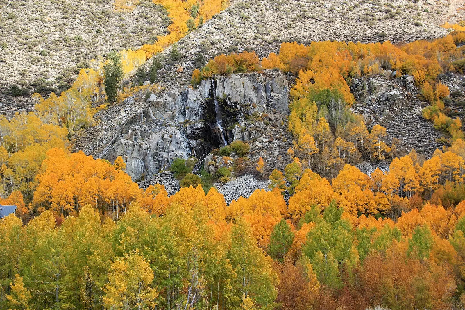
Visit California’s autumn-leaves roundup gives place windows and says the season typically kicks off in early September in the Sierra and does not fade until December in some coastal areas. That last clause is attributed on the page to the editor of California Fall Color. The place lines are the tourism page’s own: Eastern Sierra mid-September through October, Carson Pass early September through early November, Plumas County mid-October through early November, Napa mid-October through November, Oak Glen early September through November. State Parks adds two park sentences: Henry W. Coe, October is usually the best month, and McArthur-Burney Falls, usually mid-October. The San Bernardino National Forest says aspens in the San Gorgonio grove begin in late September and usually peak in the first week or two of October.
Those are different forests. Burney Falls is the mid-October state-park page. Bridalveil Fall is the Yosemite page, on the Sierra side of the tourism windows. McWay is the Big Sur page, which is the coastal end of the season, not the aspen fortnight.
Peak timing varies from year to year. A warm fall, an early frost, or a windstorm can move or mute the color, which is why the live report matters more than any calendar.
When color usually arrives
Eastern Sierra
Typical peak mid-September through October on the Visit California page. Carson Pass is early September through early November. San Gorgonio’s aspen grove, on the San Bernardino forest, begins in late September and usually peaks in the first week or two of October.
Visit California and the San Bernardino National Forest. Source: Visit California, autumn leaves.
Cascades at Burney
McArthur-Burney Falls Memorial State Park usually sees color in mid-October, on the state parks fall page. Plumas County, to the east, is mid-October through early November on the tourism roundup.
California State Parks. Source: California State Parks fall color.
Coast and valleys
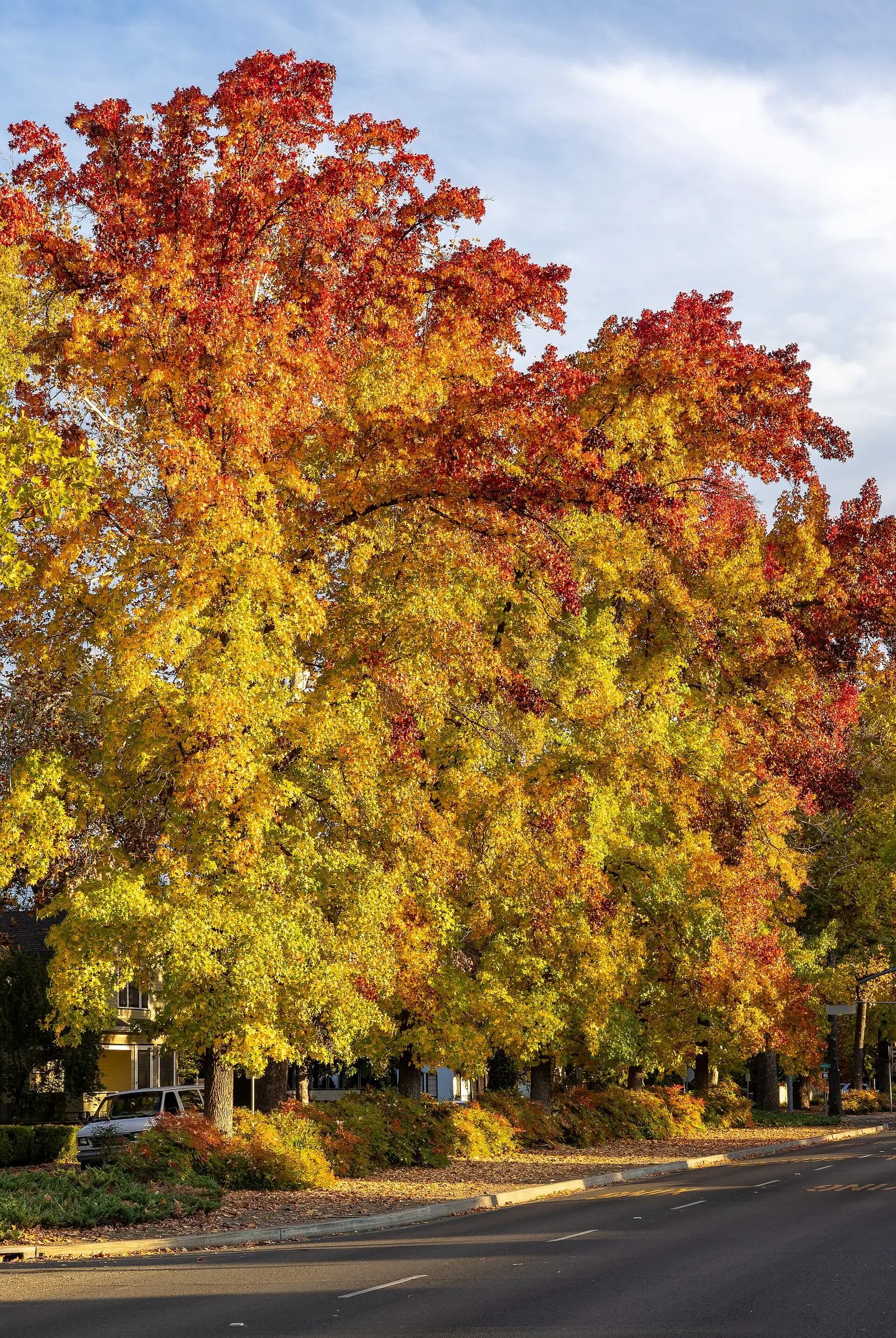
The tourism page says some coastal areas hold into December, in the line it attributes to California Fall Color’s editor. Napa is mid-October through November. Oak Glen is early September through November. Henry W. Coe is usually best in October. McWay Falls is the coastal waterfall in this set, so it takes the later coastal end, not the Eastern Sierra aspen window.
Visit California and State Parks. Source: Visit California, autumn leaves.
Fall foliage map
Esri publishes a public ArcGIS experience called Fall Foliage Viewing. It is embedded here as a map you can pan. It is not the source of the dates on this site. If the embed is blocked or slow, the state reports linked above and below still stand on their own. For California, it opens centered on the state. The center is the middle of the state's bounding box in the U.S. Census Bureau cartographic boundary, 2017 edition. The colored prediction layer in the experience is the Massachusetts Department of Conservation and Recreation forecast published in that app. It is not a forecast for any other state.
Map of waterfalls in California
Larger gold markers are the waterfalls on this page's itinerary. Smaller markers are the other published waterfall pages in California. The outline is the U.S. Census Bureau cartographic boundary for the state (2017, public domain). A marker is the mapped position of the falls, not a trailhead.
Published waterfall page On this foliage trip
On this trip
- Alamere Falls, Marin County
- Bridalveil Fall, Mariposa County
- Burney Falls, Shasta County
- McWay Falls, Monterey County
Other published waterfall pages in California
- Angel Falls, Madera County
- Bassi Falls, El Dorado County
- Berry Creek Falls, Santa Cruz County
- Big Falls, San Bernardino County
- Bonita Falls, San Bernardino County
- Castle Rock Falls, Santa Cruz County
- Cataract Falls, Marin County
- Cedar Creek Falls, San Diego County
- Chilnualna Fall, Mariposa County
- Corlieu Falls, Madera County
- Crystal Creek Falls, Shasta County
- Darwin Falls, Inyo County
- Deer Creek Falls, Tehama County
- Faery Falls, Siskiyou County
- Fossil Falls, Inyo County
- Frazier Falls, Sierra County
- Green Valley Falls, San Diego County
- Hatchet Creek Falls, Shasta County
- Hidden Heart Falls, Riverside County
- Horsetail Fall, Mariposa County
- Horsetail Falls, El Dorado County
- Huntington Falls, San Francisco County
- Kings Creek Falls, Shasta County
- Le Conte Falls, Tuolumne County
- Linda Falls, Napa County
- Loves Falls, Sierra County
- Lower Yosemite Fall, Mariposa County
- Manly Fall (historical), Inyo County
- Maple Falls, Santa Cruz County
- Mist Falls, Fresno County
- Montgomery Creek Falls, Shasta County
- Mossbrae Falls, Siskiyou County
- Nevada Fall, Mariposa County
- Nojoqui Falls, Santa Barbara County
- Potem Falls, Shasta County
- Pywiack Cascade, Mariposa County
- Rainbow Falls, Madera County
- Rainbow Falls, San Francisco County
- Red Rock Falls, Madera County
- Roaring River Falls, Fresno County
- Rose Valley Falls, Ventura County
- San Antonio Falls, San Bernardino County
- Sawyier Falls, El Dorado County
- Sturtevant Falls, Los Angeles County
- Tahquitz Falls, Riverside County
- Tehan Falls, Alameda County
- Tokopah Falls, Tulare County
- Tueeulala Falls, Tuolumne County
- Vernal Fall, Mariposa County
- Wapama Falls, Tuolumne County
- Whiskeytown Falls, Shasta County
- Wildcat Falls, Mariposa County
- Yosemite Falls, Mariposa County
Open the interactive California waterfall map. That map also includes named falls that do not have their own page.
The live report
The tourism page points readers at outside weekly reports. The windows above are the ones printed on the state and Forest Service pages themselves. Visit California autumn leaves.
Waterfalls to see with the color
Burney Falls is Shasta County. The state park says color there is usually mid-October. The USGS text gives 129 feet, and the trail file describes a short loop of about 1 to 1.2 miles. Bridalveil Fall is the Yosemite page, 620 feet in the gazetteer text, about 0.5 miles round trip. Yosemite Valley is Sierra color, and the Eastern Sierra aspen window is the tourism date for the east side, not automatically the valley floor. This page does not pretend Bridalveil’s cottonwoods and oaks are the June Lake aspen grove. McWay Falls is Monterey County, a coastal overlook of about 0.5 miles round trip, on the later coastal end. Alamere Falls is Marin County, also coastal, and a long walk. The Eastern Sierra aspen fortnight is a different trip from either coast page.
Burney Falls
Shasta County · nearest listed town Burney
- Trail
- Falls Loop Trail
- Distance
- About 1 to 1.2 miles loop
- Drop
- 129 ft in the USGS gazetteer text
- Reviews
- 1,774 · 4.8 stars
Bridalveil Fall
Mariposa County · nearest listed town Yosemite Valley
- Distance
- 0.5 mile round trip
- Elevation
- About 80 feet
- Difficulty
- Easy
- Drop
- 620 ft in the USGS gazetteer text
- Reviews
- 379 · 4.8 stars
McWay Falls
Monterey County · nearest listed town Carmel Valley Village
- Trail
- McWay Falls Overlook Trail
- Distance
- 0.5 mile round trip
- Difficulty
- Easy
- Reviews
- 646 · 4.6 stars
Alamere Falls
Marin County · nearest listed town Bolinas
- Trail
- Coast Trail
- Distance
- About 6.5 miles one way (13 miles round trip)
- Elevation
- Varies by trailhead; Five Brooks / Stewart Trail climbs over Inverness Ridge (about 1,300 feet)
- Difficulty
- Strenuous day hike
- Drop
- 40 ft in the USGS gazetteer text
- Reviews
- 414 · 4.8 stars
Trail name, distance, elevation, and difficulty come from data/trails.json or a hand-checked trip note when one exists. A missing row means that field was not in those files. Drop is shown only when the USGS gazetteer text states a height.
Burney in mid-October, the coast if you are later
Burney is the Cascades page with a state-park month. Yosemite is the Sierra waterfall, and the aspen dates Visit California prints are for the Eastern Sierra, June Lake and Bishop Creek on the Forest Service list, not for the valley parking lot. McWay and Alamere are coast. December is the far end of the sentence the tourism page attributes to a fall-color editor, and it is not a Burney date. The straight-line table is California-sized on purpose.
| From | To | Straight-line miles |
|---|---|---|
| Burney Falls | Bridalveil Fall | 251.5 |
| Bridalveil Fall | McWay Falls | 155.2 |
| McWay Falls | Alamere Falls | 138.4 |
National parks on our guides
Yosemite, Kings Canyon, Sequoia, Lassen Volcanic, and Death Valley all have guides. Bridalveil is the Yosemite waterfall on this foliage list. Death Valley is not a foliage park in any source used here, and this page does not give it an aspen week. Lassen’s neighborhood, on the Forest Service fall guide, is aspen, willow, and alder around Hat Creek and Lake Almanor, which is closer to Burney’s mid-October note than to the Eastern Sierra.
- Yosemite National Park — 12 published waterfalls filed in California
- Kings Canyon National Park — 2 published waterfalls filed in California
- Death Valley National Park — 1 published waterfall filed in California
- Lassen Volcanic National Park — 1 published waterfall filed in California
- Sequoia National Park — 1 published waterfall filed in California
Trees and the colors they are credited with
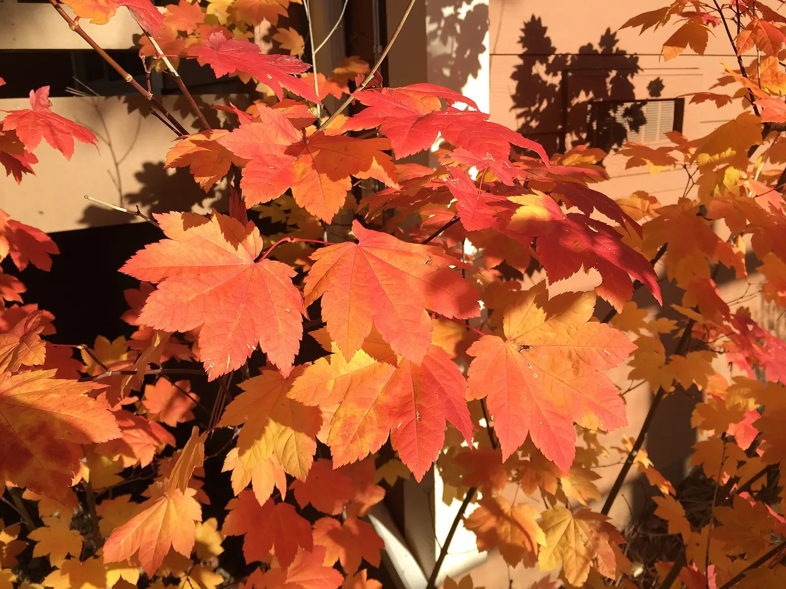
- Aspen, cottonwood, dogwood, maple, oak. Visit California names aspens, cottonwoods, dogwoods, maples, and oaks, and adds Pacific dogwood and bigleaf maple for Plumas. The San Gorgonio note lists quaking aspen plus black oak, bigleaf maple, Pacific dogwood, willow, and western sycamore. The national Forest Service guide says the same for the Inyo and for the Sierra near Yosemite. (San Bernardino National Forest, fall color)
Frequently Asked Questions
When is Eastern Sierra aspen season?
Visit California says mid-September through October. The San Bernardino aspen grove usually peaks in the first week or two of October, after a late-September start.
When is Burney Falls?
California State Parks says usually mid-October at McArthur-Burney Falls.
Which waterfall is the coastal page?
McWay Falls in Monterey County, with Alamere Falls in Marin County. They are not on the Eastern Sierra aspen window.
Photographs
Sources
- Visit California, autumn leaves
- California State Parks fall color
- San Bernardino National Forest, fall color
- File:Golden fall foliage - Flickr - daveynin.jpg
- File:2015-10-30 16 27 38 Vine Maple foliage during autumn along Old Brockway Road in Truckee, California.jpg
- File:Fall colors along the Esplanade in Chico, California-9707.jpg